This is a summary that previews 13 day hikes around Blantyre, Malawi, 3 weekend outings and 3 treks in the Mulanje range. It also includes additional resources such as Maps & Facts (GPS data and logistical details necessary for the reader to recreate the adventures). Costs and links to additional resources are included.
![]() Each is rated between Easy and Extreme based on my limited abilities.
Each is rated between Easy and Extreme based on my limited abilities.
Enjoy Malawi outdoors.
Watched the combined episodes in this one video.
Southern Malawi
Mulanje Area Hikes and Treks
Checkout Mulanje Maps & Facts for logistical details.
Includes 3 minute Adventures video.
A two-night and three-day trek to summit the highest peak of the Mount Mulanje range at 3,003 m.
Visit the Saptiwa Summit Post here.
This is the classic Lichubula – Chisepo – Chambe route.
Includes 3 minute Adventures video.
This is a 5-day, 4-night trek that crosses the top of the Mulanje range from the southwest (Mulanje Boma) to the Northeast (Fort Lister).
Visit the Grand Traverse post here.
Includes 3 minute Adventures video.
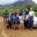 Madzeka Hut Trek Or Summit Nayawani South
A two-day trek up to the Madzeka hut and then a short hike to the nearest summit followed by a long slog back down the mountain.
It was done with the local Mountain Club of Malawi and included a diverse set of characters, from old (me) to very-very young.
Visit the Madzeka Hut blog post.
This is a 3 hour round-trip hike from the Likhubula park gate area to the Likhubula Waterfalls.
If you are willing to walk another 30-60 minutes up the road you will reach a much better and totally secluded swimming hole.
Visit the Likhubula Waterfalls post.
This is a day hike to the Mbiya Pools of the Ndiza River, from the Lujeri Tea Estates.
The Lujeri Tea Estates are pretty enough to be the objective of a day walk, but the Mbiya Pools are close and lovely, so consider them a bonus.
Visit the Mbiya Pools Day Hike post.
13 Day Hikes Around Blantyre & Outings
The plan!
The Actual Events!
1. Nyambadwe Hike – I did not do this Hike. Check out the Chris Dodd site for details.
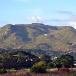 2. Mt Mpingwe Peaks Hike
From Blantyre/Limbe, Mt Mpingwe is a daily sight with its exposed slopes and towers on peak.
From the start at the M4, through the township, up the dirt road, up the trail to the new water tower and then up through the cultivated fields to the western peak spur I had traveled 3.31km in 1 hour and gained 325m.
A 2.5 hour, not very inspiring hike but an easy walk from Limbe if you want a good view of the surrounding hills, mountains and housing sprawl.
Visit the Mt Mpingwe Peaks Hike post.
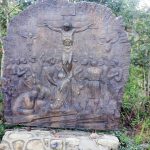
This is a very comfortable and spiritual hike at the southern end of the Michiru range. It has both a very well groomed trail (with the stations of the cross), a double-track and a good trail.
The entire loop that I have mapped out takes around two hours, covers 5.10km, gains 278m elevation and combines a forest trail hike, a plateau track hike, culminates at the summit cement cross and then descends on the well groomed (stone path with the stations of the cross) back to the starting point.
Visit the Way of the Cross Hike post.
The hike is an easy 2-3 hour workout that will get you sweating on a sunny day, will offer outstanding views, and will get the adrenaline going if you scramble up the final exposed section.
There is an alternate ascent from the SE side of the mountain and a base loop trail that can be combined to create a large loop hike.
So all in all, it is highly recommended.
Visit the Soche Summit Hike post for details.
5. Dead Mans Gully Hike – I did not do this Hike. Check out the Chris Dodd site for details.
Mt Bangwe, on the eastern side of the Bangwe township is a prominent backdrop as seen from Limbe. It takes about an hour to reach the peaks from the lower township with an overall gain of around 300m.
There are actually three peaks on this mountain. The first (lowest) is marked by a circular cement column, the central is the highest at 1526m with a number of small boulders and the third at 1523m with a large boulder. They are within a half km of each other and easy to access once on the upper rolling summit hills.
Visit the Bangwe Peaks Hike Post for details.
Malabvi is the third and highest of three big peaks that are passed as you head east out of Limbe on the main Midima Road (M4).
The start/finish is from Nchele village, via a dirt track reached easily from the M4.
A difficult hike at times due to high vegetation in the rain season and steep upper slopes.
Visit the Malabi Summit Hike Post for details.
8. Ndirande SE Hike – See #12 below.
9. Mthawira Hike – I did not do this Hike. Check out the Chris Dodd site for details.
The Michiru peak hike is a day outing near Blantyre, in Southern Malawi.
This day hike is within the city limits of Blantyre. From the Forestry Office it takes about 2.5 hours to reach the summit at 1469m (gain of 632m) and re-trace your steps.
There are a few option that can be added to this hike that turn it into a large loop and even a route from the southern ‘Way of the Crosses’ section I’m told.
Visit the Michiru Summit Hike post for details.
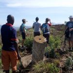 11. Mpemba Peak Hike
This was a Sunday outing with the Mountain Club of Malawi (but on a Saturday).
It was an easy hike to the peak of a Blantyre local hump (AKA hill).
This hill is within easy reach of the surrounding villages and therefor is completely cultivated. Even on the top.
Visit the Mpemba Peak blog for details.
This hike has three options. A long leisurely walk along a 4×4 track to the range’s southern cell towers (known as the Kamuzu Lookout). A short hump to the top of Wall Hill (a rock climbing hill) for the views and an old structure. And finally, to the summit of Mt Ndirande.
These are all family-friendly hikes but the Mt Ndirande hike requires a bit of bush & rock scrambling, albeit nothing exposed or dangerous.
Visit the Three Mt Ndirande Hikes post.
The hike starts from the Lisawo primary school and church at 1067m. It takes around four hours after leaving the school to reach the central summit at 1797m. An elevation gain of 846m.Half that time to descend.
There are a two other summits/protrusions that are a few meters lower than the boulder central summit. One on each end of the wide ridge.
This Chiradzulu should not be confused with a mountain of the same name on the Zomba plateau.
Chiradzulu Peak Hike Near Blantyre for details.
Two hikes, the Western and Eastern loops are detailed.
These range from Sunbird/Trout Farm, William’s Falls, Emperor’s Lookout, Mulunguzi Dam and the grotto. Each loop takes 3 hours or 5 hours combined.
The Zomba Plateau offers 11 walks (hikes) of varying lengths (from 35 minutes to 6 hours in duration or any combination of sections).
Visit the Zomba Plateau Hikes post for details.
The Zomba Mt Malumbe hike is a day outing near Blantyre, in Southern Malawi.
The summit hike of Mt Malumbe (2077m) was lovely, the views spectacular, the landscape lusciously green and the trail easy to walk.
Most of this hike covers the same route as the first quarter of the Zomba Western Loop hike.
Visit the Zomba Mt Malumbe peak post for details.
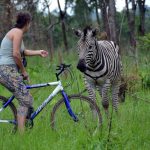 16. Game Haven Wilderness Ride
This is a lazy half-day outdoor luxury adventure at the Game Haven Lodge, just outside the town of Limbe (Blantyre).
It’s also a well know overland stopping location and an expat weekend family favorite hangout.
And it is one of only a few places open for meals on Sundays.
Visit the Game Haven Wilderness Ride post for details.
Other Southern Malawi Outings
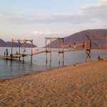 Kayaking Cape Maclear Weekend Trips
In this post I will explain a few simple facts and my experiences (and opinions) about my Cape Maclear visits.
The post covers two visits, one staying on the mainland and the other on Domwe Island.
Visit the Kayaking Cape Maclear post.
 Weekend Visit to Majete Wildlife Reserve
On this outing we stayed at the N’gona Lodge outside the Reserve because of the outstanding food, campsites and infinity pool facing the Shire River.
We also visited the Reserve for a morning and evening game self-drive.
All in all, on my next visit I’d opt for staying in the Reserve at a Lodge with a waterhole.
Read the Majete Wildlife Reserve post to find out why.
Middle and Upper Malawi Outings
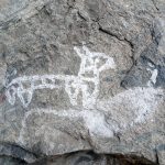
Chongoni Rock Art Day Hikes
Details about our visit to two Chongoni Rock Art sites (Namzeze and Mphunzi) near Dedza.
The Chongoni Rock Art area consists of 127 rock faces and shelters over 2,000 yrs old (most of which is in the Chongoni Forest Reserve).
 Mua Mission Side Trip
An easy side trip from Dedza (about 20km east via a long and winding descent) or a rest stop if driving up the M5 highway.
The oldest Catholic mission in Malawi, it sits on the base of the Rift Valley escarpment along a fast flowing NuNgoni river and waterfalls.
It was established by the White Fathers in 1912.
Overlanding Middle & Upper Malawi
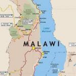 Visit Africa Overland Malawi (Overland Africa Series) post for the following activities and videos.
Livingstonia Mission, Malawi
Mkhata Bay Village, Malawi
Nkhotakota Game Reserve, Malawi
Other Resources for the New Expat
Checkout Mulanje Maps & Facts for logistical details.
How to Buy/Sell or Overland with a Car in Malawi (for Expats) page.
