
The Michiru peak hike is a day outing near Blantyre, in Southern Malawi. I provide details that include maps, costs, logistical requirements and facts as well as links to additional details, photos and videos. This is a self-guided adventure on a shoestring. Follow the links to dig deeper into the adventure.

This day hike is within the city limits of Blantyre. Drive as though visiting Casa Mia Restaurant and at the start of the dirt road you see a sign to the left pointing to the Michiru Forestry Office. The road gets a bit bumpy when you cross the rive (dry) but it is possible with a normal car if you are careful.
The Forestry office is staffed with rangers so parking is safe. They also provide armed guides upon request (don’t know why). There is also an info and picnic area so expect a lot of school kids on weekends.
 Michiru peak Hike Details

 Basically we followed trail #2 to #3 and then #4 to the summit. We then returned the same way rather than continuing on #4 to do a loop.
The hike is a bit strenuous if you push the pace. If you take your time it is family friendly and has no real difficult spots. Note that the creeks were dry in October, but may be an issue in the rainy season.
There are yellow cement pyramid cairns to mark the trail and some stones have directions painted on them.
Michiru peak Hike Summary
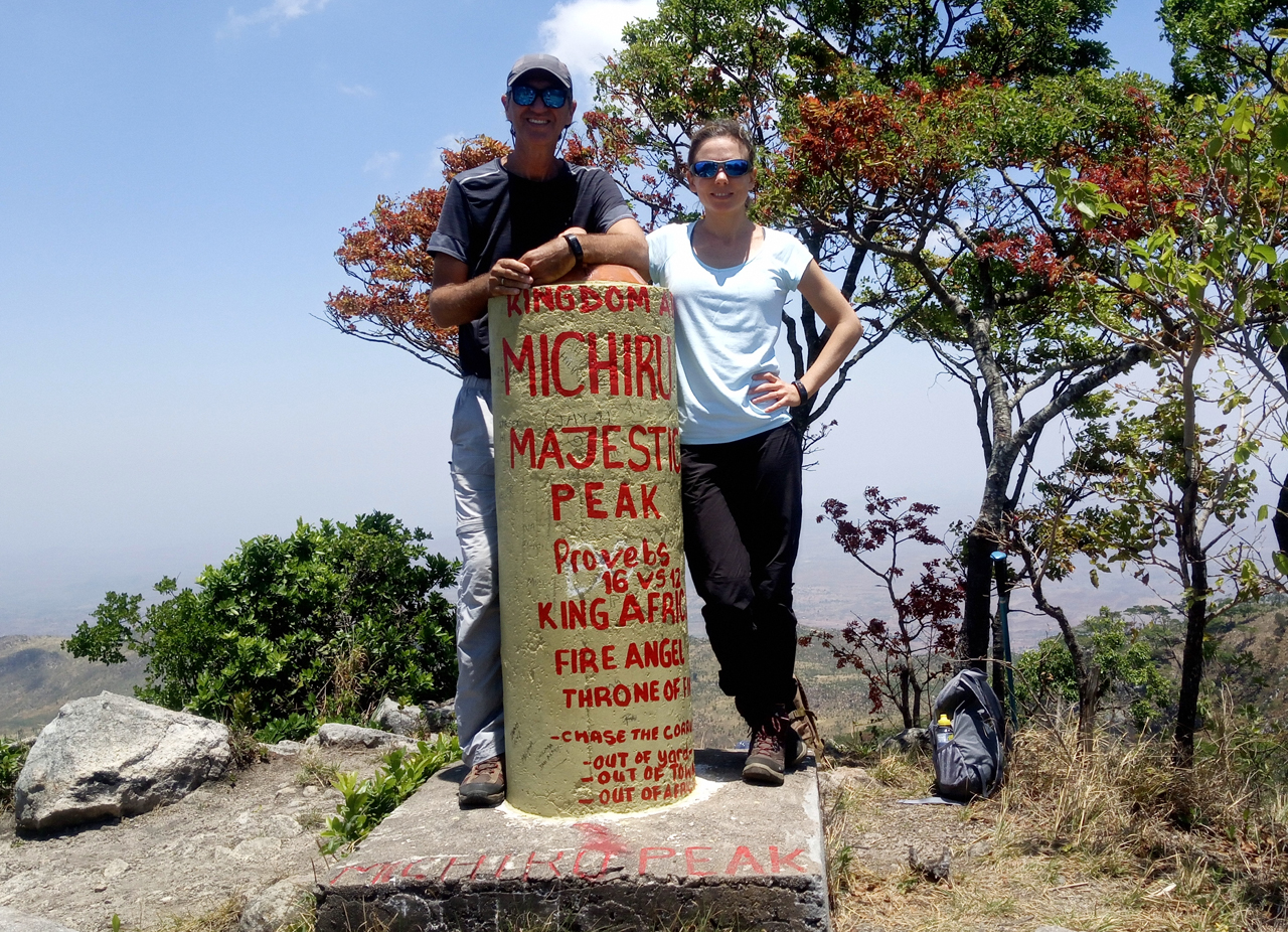
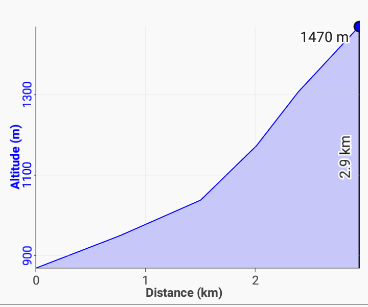 In summary, follow trail #2 along the edge of a river to the junction with trail #7. Go right to continue to the summit. You will then cross 7 small ravines (crossing creek beds). Then a steep section to a rolling plateau (with few trees). Then a final small steep sections through some boulders to a ridge line. Follow the ridge to the right for 100m and you will see the summit marker (large cement post).
The attached route-10-michiru pdf file contains an older write up about the mountain that may be of interest but it is from the days prior to GPS.
If this is all a bit confusing see the GPS section below to download the waypoints, tracks, profiles and meta data to your phone.
Views of the area and distant city are very good when the air is clear and it is a good spot for a break before continuing on a loop or back-track return.
GPS Data
The posted map is in need of repairs. Download the michiru summit gpx file and load it into your phone’s Google maps or a phone GPS app such as Locus. Then you will have a track on your phone that you can follow when confused.
Checkout Mulanje Maps & Facts for more logistical details.
Visit Malawi Outdoors on a Shoestring for more adventures
