
The Soche summit hike is a day outing near Blantyre, in Southern Malawi. I provide details that include maps and facts as well as links to additional details, photos and videos. This is a self-guided adventure on a shoestring. Follow the links to dig deeper into the adventure.
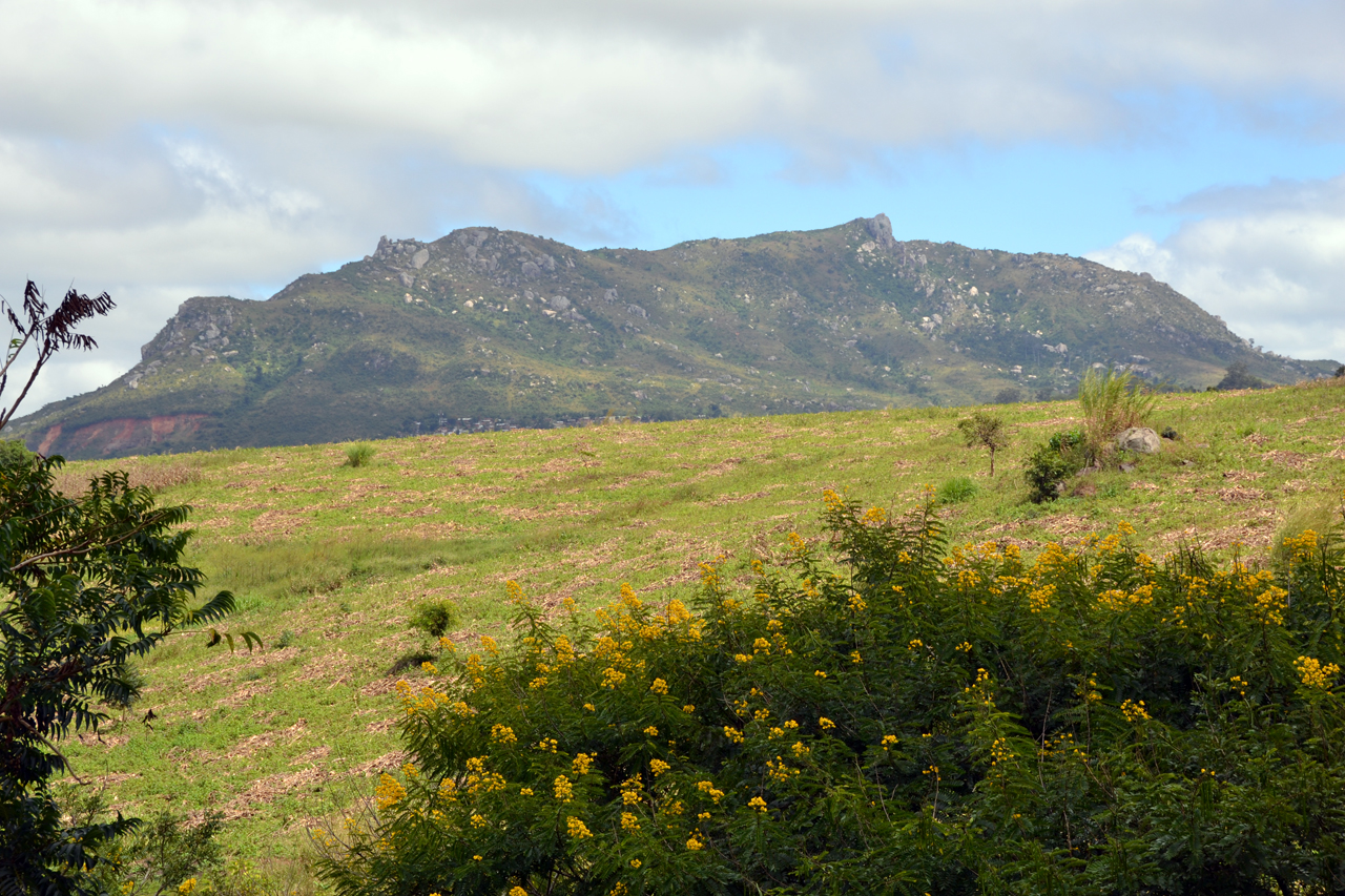
The Soche summit hike is actually less than a day hike. It’s more like a morning or afternoon hike, even for slow walkers. The hardest part is finding the trailhead among the winding township roads  around the base of the mountain and later the actual rock peak scramble, which can be a bit daunting if you’re afraid of heights.
There are two starting points for the hike and it can even be done as a loop hike but I kept it simple and started and finished near the Soche Living Waters Church since that was a relatively easy landmark to find.
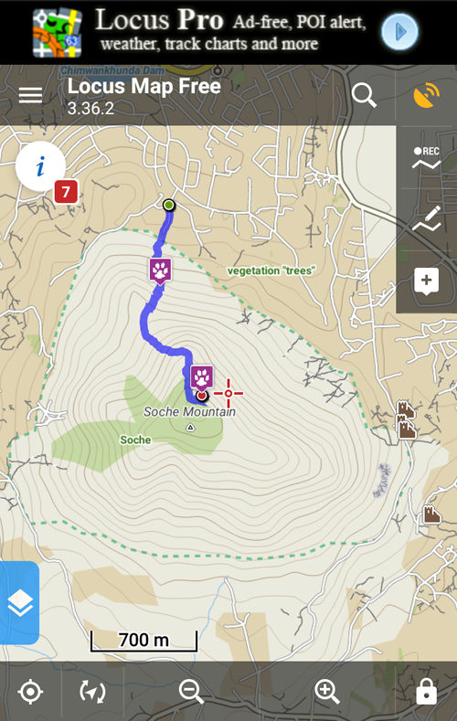
See the attached Soche_gps_files zip for route, waypoints and hike meta data.
Soche Summit Hike Details
Turn right (towards the mountain) on the first road past the church and park as far up the road as you wish. You then follow this semi-paved road uphill toward the mountain (among and to the right of the ever increasing number of homes).
 After the last house (between two close homes) the trail is easy to spot since it runs up or left/right. The left/right is part of the loop at the base, while the up is the primary trail to the summit hikers, wood collectors and religious fanatics. There are constant informal gatherings, loud preaching, singing, chanting and other religious activities on the lower slopes of this mountain every day (at least in the area this trailhead based on my multiple visits).
Stay on the main trail until you see a cut right a short distance below a large boulder/pillar (about the 7th right cut). See Cut Right waypoint in the Soche_gps_files zip for exact location. Do not continue straight as the trail cuts left, drops into a stream bed and then continues left towards another open church gathering spot.
Cutting right takes you past the mouth of a cave that seems to be occupied by two hermits who also hold services. They always say hi, but are harmless and friendly.
The trail about 200m past the cave then enters a rock and flower garden with numerous painted religious slogans. Continue climbing uphill to the saddle between the peak and a smaller hill to the north (right). This is the steepest section.
Soche Summit Hike from the Saddle
Once on the saddle the trail turns left towards the peak. Going right takes you to the top of the smaller hill and local people speaking in tongues or chanting.
After a short gentle section on the saddle the trail heads up the north and wraps northeast to emerge on a bluff just below the summit. Another short easy section takes you to the base of the summit.
Here you have to cut to the right to circle around to the back to the summit boulders and do some zig-zagging to get to the base of the large summit boulder. There is a comfortable place to sit on large rocks at the base or you can scramble up the steep and exposed final pointy boulder to reach the summit, which has a cement column at the peak.
There a small watercourse carved down the center of the summit boulder which also has some hand or footholds, so it is manageable to scramble up (staying in the center) but the drop off to you left and right are daunting.
Soche Summit Hike Conclusion
The hike is an easy 2-3 hour workout that will get you sweating on a sunny day, will offer outstanding views, and will get the adrenaline going if you scramble up the final exposed section. So all in all, it is highly recommended.
Soche Summit Hike Alternatives
You can also start/end this hike from the Soche Secondary School. See the attached route-04-mt-soche by Chris Dodd for details. I started and ended at the same place. But by starting on one side and ending on the other and then using the lower slopes loop trail you can turn this into a good day loop hike.
The ViewRanger phone app (with free Malawi map) has the entire route marked, including the loop section.
Per Marc Henrion, the official boundary route is quite nice, though in places not that easy to stay on the paths because fields have crept up the hill across the boundary.
Here is the Soche Forest Reserve Boundary data on Strava.com that Marc provided.
Soche Summit Hike GPS Data
Download attached Soche_gps_files zip and load it into your phone’s Google maps or a phone GPS app such as Locus. Then you will have a track on your phone that you can follow when confused.
Visit Malawi Outdoors on a Shoestring for more adventures
