
The Malabvi peak hike is a day outing near Blantyre (Limbe), in Southern Malawi. I provide details that include maps, costs, logistical requirements and facts as well as links to additional details, photos and videos. This is a self-guided adventure on a shoestring. Follow the links to dig deeper into the adventure.

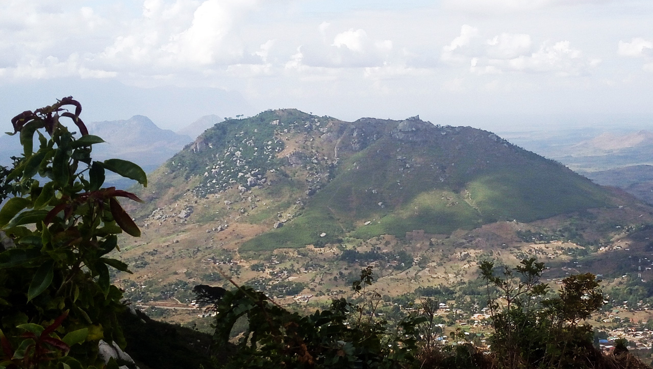
Malabvi is the third and highest of three big peaks that are passed as you head east out of Limbe on the main Midima Road (M4); Mpingwe and Bangwe are north of the M4, with Malabvi on the south. It is about 6km from the M3 & M4 fish round-about.
The route is steep and difficult to follow in the wet season due to very high grass. The orange clay soil of the lower slopes are also very slippery when wet. The route offers plenty of variety and some excellent views of the surrounding area.
The legend goes that when the explorer Dr David Livingstone and his men were exploring the region they asked a local the name of the mountain; thinking that they were being asked the name of the wider area rather than just the mountain, the local responded ‘Malawi’ which led to the mountain being named Malabvi.
Malabvi peak Hike Trail Head
The start/finish is from Nchele village, via a dirt track reached easily from the M4. See the malabvi gps gps file for tracks and waypoints that can be loaded into your phone. There are two spots you can turn off M4 to reach the village. The first has some covered selling stalls and the second a large cement sign to a church/school just over the hump. The first is directly across from the electric power transformer yard (within high brick walls).
Malabvi peak Hike Route
 Park your car just off the M4 or driver further into the village (via dirt road). Walk through the small cultivated fields, climbing slowly. The real trail begins at a large boulder with a natural spring at its base. This at the bottom of a gully.
Follow the goat track up to the left of the gully until you reach a cave. There are a number of fire break trails at the mid-section of the mountain that lead across to the right side of the gully. Ignore them and stay to the left.
From the cave, the trail becomes more difficult to find. Exit the cave to the right (under low hanging trees and bushes) onto a stone shelf.
Work your way up the slope keeping to the right of the cave and left of the ravine. The false summit is to your right and looks like a large hooked hump. The actual summit is a few hundred meters to the left of this hump.
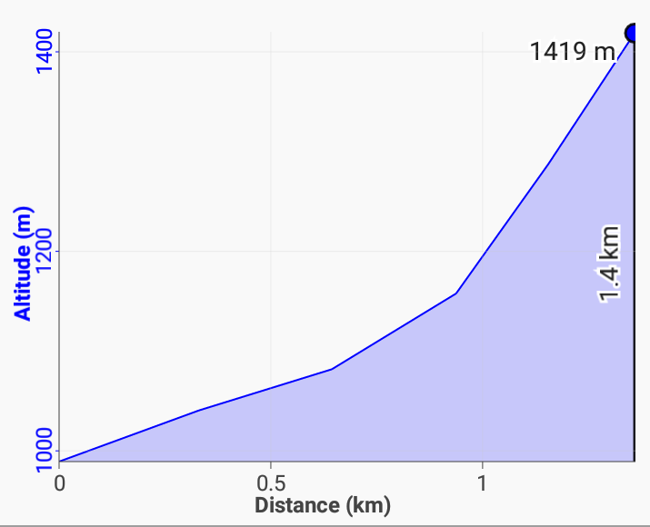
Zigzag your way up, almost directly above the cave previously passed. The summit is marked by a large cement column on top of a boulder on the ridge (not visible until almost on the ridge). There are some climbing spikes driven into boulder to help you reach the upper column with a broken iron railing.
You’re on the top.
Peaks visible from the summit include: Mulanje Massif (ESE); Mt. Soche (W) and Bangwe (NW).
The attached route-07-malabvi pdf document indicates that there is a alternate trail climbing to the west of the cave to reach the crest a few hundred meters west of the summit marker.
Malabvi peak Hike GPS Data
 If the above text seems confusing then simply download the malabvi gps gpx file and load it into your phone’s Google maps or a phone GPS app such as Locus. Then you will have a track on your phone that you can follow when confused.
Open the route-07-malabvi pdf file to view an older document by Chris Dodd about this mountain.
Checkout Mulanje Maps & Facts for more logistical details.
Visit Malawi Outdoors on a Shoestring for more adventures
