
This post will outline my hike to Peak Daniele, in the Bosch di Malabotta Nature Reserve, located north of Etna Volcano. This was a CAI (Catania Alpine Club) excursion. I will provide details that include maps, costs, logistical requirements and facts as well as links to additional details, photos and videos. This is a simple day hike/adventure on a shoestring. Follow the links to dig deeper into the adventure.
Difficulty Level:
 Narrative
Our goal was the top of the top (Pizzo Daniele) in the Sicilian Bosch di Malabotta Nature Reserve. We set out from the Catania Alpine Italy club, (in Catania naturally), in their shared club van at 7:30 am. We did the mandatory Italian coffee stop along the way to break up the long drive north.
We made it to the trail head car park at the end of a winding remote road without incident and were off by 9am. The group consisted of Fabrizio as guide (a biologist by trade) and a rag-tag group of 12 hikers of various ages (say mid-30 to mid-70). The latter did better than some of the younger crowd.
![]()
Total Cost Range of this Activity is: $
The hike zigzagged up hill all the way and basically paralleled a dirt track. In fact we used the dirt track to return to the car park. You can walk this hike in either direction. The road is easier but a bit longer. A few times we cut some corners and took goat tracks at best.
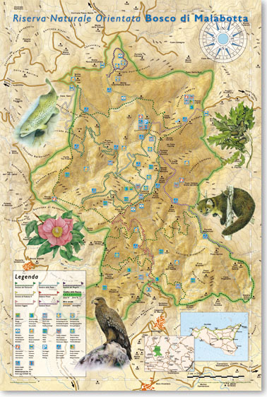
My Waypoints on a map:
If you want the GPX file with the waypoints, please leave a comment request and I will email it. Waypoints created using TrekTracker software.
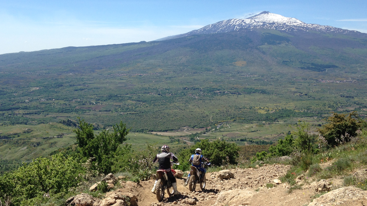
By 12:01 we were on the summit. A rocky outcrop with spectacular views of the valley and Mt Etna volcano. Note that the volcano still had snow on the north face while the south was clear.
Rather than take lunch at this extremely windy spot we walked northwest for almost an hour to find a sheltered spot for lunch.
Click to watch Video
Hikes around Catania, Sicily, Italy
After a long lunch break (self catered) and a show of male cow prowess (aka bull in heat) we followed the dirt track downhill in a winding course that took us back to the car park. We completed the hike at 5pm for a total walking day of 7h 58m according to my trekking tool called Locus Map. A free app that does it all. Visit here for details. Unfortunately my old iPhone does not have pedometer capabilities so I don’t have the step/distance details.

Hike Photos