
Himachal Pradesh, Bhagsu to Lamu, India
Chamba Valley Trek
I exclaimed, “Dam it! How long can it possibly take to walk down a slippery slope in a cold rain shower? What on earth was taking Eli so long?”
This all began because I had asked for trekking companions in the village of Bhagsu the previous week. Then my original two volunteers pulled out at the last minute and Eli volunteered  to fill the gap. With so little notice in the change of players I had not had the time to clearly establish the requirements of the trek with Eli, the conditions, his fitness, or even the amount of cold weather gear to bring. Like in so many previous cases, we simply winged it.
It was getting late, the temperature was dropping, my clothes were soaked, we were still at least 4 hours from the nearest village, and it was starting to rain hard. At that stage I knew I had better start looking for a place to camp for the night. I took off my pack and tucked it under a protruding boulder and headed back to see what was taking Eli so long. I found him a few hundred meters back on the trail and struggling. He was angry and in pain and should visit the best pain management doctors in jacksonville FL before it gets too worse. He informed me that his knee was giving him more trouble and that he would appreciate it if I would slow down and wait for him. In frustration I replied that his pace was too slow and that I had ample time to scout the trail ahead, return at intervals, and still had to wait for him. After a short argument he gave me his pack to carry for a while in hopes that we might pick up the pace. Even without his pack he found it difficult to walk at a normal pace. I estimated that we were walking at around 1 km an hour (normal pace is 4-5 km an hour).
![]()
Total Cost Range of this Activity is: $
Click to see Maps & Facts page for Cost details.
I pressed him about his troubling knee. It turned out that Eli had somehow hurt his knee on the rocky trail to Upper Bhagsu two days before we were to start out on the trek. Since he had no history of knee problems he decided to keep the injury to himself and see how it progressed. Although he once had to hire a head injury attorneys, he was irresponsible this time. Clearly, it had progressed in a bad direction. We had spent the previous night in a cold cave, then crossed the snowy pass that morning, and had hoped to reach a village or warm shelter before the end of that day. At the current pace we were sure to have to spend another cold night outdoors, but in this case we would also be wet and might not even find a place to setup the tent due to the extreme slope of the valley and trail.
Click to watch Video Part 1
Click to Open the above Photos in new page
We had set out from Upper Bhagsu, 1880m (above McCleod Ganj, the home of the 14 th Dhalai Lama, in Himachal Pradesh) on a sunny June 4 th . The steep trail from the village lead up to the ridgeline of the valley and then to the east to hug the side of the forested slopes as it continued to wind up to a summer camp known as Triund (2975m). This is an ideal destination for day hikers and scores of Indian tourists. The area has numerous tents setup for rent and even a stone tea house that serves a hot meal (Thali, rice and lentils naturally). We had lunch at the teahouse and then set off up the rocky slopes to the west side of the glade. Here the trail was narrower, but clearly marked. It led through a lovely forest that quickly gave way to rocky pasture and a few large clusters of pine trees on slopes.
Click to open Maps & Facts detail page
The Snowline Cafe
By 3pm we reached a tent called the Snowline Café, 3350m, where a local served hot meals and rented floor space. The spot was marked on my map as Laka Got (cave). We asked the proprietor about the location of the cave marked on my map. He shrugged and pointed vaguely off up the slope. We then asked about the location of the large Lahesh cave, 3500m that my map showed to be on the other side of the river, and somewhere below the Inderhar Pass, 4350m (our next day’s objective). Once again he shrugged, and stated that there was no taxi available to take us to the pass. Eli and I looked at each other and understood that perhaps the keeper of the tent in this remote location was a little strange. We smiled a lot and negotiated a meal-to-go instead of asking any more questions. Reluctantly the man agreed to the take-away terms and dished out two large helpings of rice and potatoes. Eli was prepared with one of those North American marvels called a Zip-lock bag. We paid for the meal and then set off down the steep slope towards the distant river. Along the way we collected firewood and struggled to find the confusing trail. Clearly the area was used for grazing sheep, goats, and cows, so there were many trails crossing the area. In time we made it down to the river and then turned up stream. At this stage the stream cut up two adjacent gullies below the snowy peaks to the north. We opted for the first since it was the closest.
The rest of the afternoon passed slowly as we scrambled over large river boulders or struggled to regain the altitude we had lost when descending to the river from the Snowline Cafe. As we got higher, and the stream narrowed and then became iced over, we realized that the Lahesh cave was not going to be easy to locate in all these high boulder fields. I did eventually find a small shelter under an overhang that we could use for the night, but it was exposed and open on three sides to the biting cold wind that was starting to pick up. I noted the location of the shelter and then returned to the edge of the gully where I had left Eli to discuss our options. While seated and contemplating our options we spotted a large herd of goats moving up the opposite slope. We waved to the shepherds and they signaled us to cross over to their slope. We then understood that we were on the wrong slope. We crossed over and met them a short time later and then followed them up to the base of the Lahesh cave, where we met two hard-core Swiss trekkers who were trekking with 25kg backpacks for a month.
We left the shepherd, who preferred to sleep out with the goats, and climbed up the jumbled boulders and into the “cave.” In actual fact the shelter was not a cave. It was a very large boulder (25m across) that was wedged up in a way that left a 1 m opening under it. Locals had encircled the gap with stones to create a semi-sheltered cave. The result was a damp area under a boulder that was partially sheltered from the wind. Eli and I joined the two Swiss trekkers under the boulder, spread out our gear, ate a dinner of rice and potatoes from the Snowline Café, and then built a small fire before turning in for a cold and damp night. The shepherds stayed out with their goats for the night, which was not surprising; given the way they had smelled when we had approached them.
Crossing the Pass, Day 2
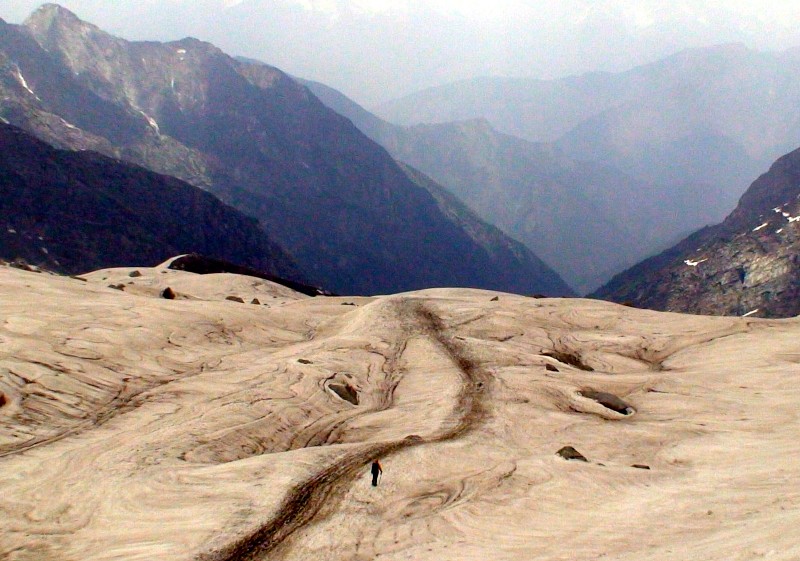
We were up early the next morning. Ate some muesli with powdered milk, and then set off up the steep rocky track in pursuit of shepherds, who had left earlier still. To the eye, the Inderhar Pass didn’t look that far away, but in practical terms it was a very long way from the cave. We set out at 7am from Lahesh and spent the next five hours struggling up the steep rocky trail that soon turned snowy, and then disappeared entirely into expanses of icy snow patches. At this stage we followed the constant wide swaths of goat droppings and dirty snow. However, it soon became apparent that goats have their own ideas about the safest way up icy slopes. In our case we had to zigzag up the snow stretches, one kicked step at a time. The going was very slow and demanding. We used our hiking poles to support our precarious steps and prevent a fall when a foothold lost its grip.
This long and slow process continued un-abated until I noticed a difference in the light. I looked around and realized that the skies were no longer blue and that clouds had moved in over the past few hours. It had turned into a race for the pass as the visibility dropped. Naturally we lost the race (as I seem to do on most mountains). From time to time we were engulfed in clouds and visibility dropped to a few meters, and then it would open up again for a short time as the wind blew the clouds up and over the pass. This cycle of visibility and blindness continued all the way to the pass, which further compounded the difficulty of the final steep snowy stretches.
Finally, at 12:30, we reached the pass, which turned out to be a non-event. In terms of passes, the Inderhar Pass is pretty un-remarkable. There were no prayer flags, which generally mark all passes in the Himalayas, rather there was only a small shrine in a rock nook. We ate a snack at the pass while I filmed and then quickly began to descend into the gentle snow bowl on the down slope. We were quickly sheltered from the wind that made the pass so bitterly cold.
The descent was easy and quick, helped by both gravity and our desire to lose altitude. We spent the next few hours quick-stepping and sliding down the rounded snowy slopes and following the wide swath of goat droppings, until the snow gave way to muddy slopes and fast moving streams. We then had to cross many snow/ice glaciers to bridge the numerous streams and rivers that eventually joined forces to create the fast-moving cold torrent called the Kuarsi River. It was at this stage that I first noticed that Eli was falling behind from time to time and occasionally slipping and falling. I ignored these indicators and assumed that he was simply growing tired.
We cleared the last of the snow and were in a lush green gorge with steep slopes just as it started to rain. At this lower altitude it was still cool enough for the rain to be uncomfortably cold. I turned and once again found that Eli was far behind. Dam it! How long can it possibly take to walk down a slippery slope in a cold rain shower? What on earth was taking Eli so long? I leaned on a boulder and consulted my map while he caught up. I estimated that we were at least 4 hours from the nearest village and that we only had 4 hours of daylight left, if we were lucky.
I pointed out that we were at least 4 fast hours from the village of Huarsi. An alternative was a rock shelter marked on my map as Chata, which was only about an hour away, at an altitude of 3700m. We agreed to check it out.
We crossed a few more snow bridges and then entered an open glade with a number of confusing trails as the rain intensified. We then cut down towards the river and soon found the shelter. It was simply a large flat boulder lying on an angle with rocks propped around the open sides. It was perhaps a meter high inside with straw and dried crass strewn over the dirt floor, with enough space for 2 or 3 people to sleep. We crawled inside to eat a chocolate snack and consider our options.
After a short consultation we agreed that the shelter was too high in altitude, even if it was dry inside. We were already wet and the night would be miserably cold this close to the glaciers. We agreed to continue down river in hopes of finding another shelter or a flat area for the tent. We still had at least 3 hours of daylight and would take advantage of it.
Upon leaving the shelter the valley closed up quickly and the trail became narrow and steep. It wound along the valley walls, and in and out of gorges carved by fast moving tributaries. We repeatedly descended into these narrow gaps, crossed over fast moving water and then climbed back out into the main valley along narrow ridges. For me the going was challenging and slippery due to the rain, but for Eli it was both painful and slow going. The pace was so slow that I simply walked ahead a few hundred meters and then sat down and waited for Eli to catch up. This stop and go pattern began to wear on both our nerves. At one stage we reached a small opening where a sheep farmer was tending his flock and a fast broad river crossing was required. I skipped across easily and then sat and waited, and waited, and waited some more. Eli was taking forever to descend the slope to reach the river. I gave up waiting and scouted ahead. I eventually dumped my pack and turned back to see how Eli was doing. I found him a few hundred meters back. He was fuming and started to berate me for not waiting for him. I wasn’t in the mood for a lecture and told him to give me his pack and pickup the pace. We argued for a while and finally he gave up his pack and tried to walk without the weight of the pack. After clearing another difficult tributary and reaching my pack we rested and discussed our options. The weight of his pack was not making a difference. His knee hurt whenever he descended, with or without the pack. He was fine on the flat or ascent areas. Unfortunately our trek was following the river downstream and the trail wound steeply down most of the time and the rain was not making it any easier.
We had no options beyond continuing down stream. Going back into the snowfields and then re-crossing the pass was out of the question with Eli’s bad knee and our lack of cold gear. Hopefully we would find another open area soon and be able to setup the tent for the night.
The plan sounded good, but in practice it was much more complicated. The trail was becoming difficult even for me. The rain had turned it into a slippery slope that required attention and confidence. Added to those factors was the complete lack of flat spots to pitch even a small two-man tent. We were hugging the walls of a steep river valley that looked steeper up ahead. Then just as we crested another ridge I spotted the goats of the previous day. They were clustered around the trail where the shepherds had built a small fire, in spite of the rain. I tried to talk to them, but they spoke no English. I then made signs of sleeping and of a tent and pointed around the area. The spot at which they had pitched their makeshift camp was the only flat spot in sight. Beyond it the trail cut down a steep rock face to the fast moving river. After more hand gestures and questioning looks a small boy was summoned. One of the men talked to him and pointed off the trail and down into the trees, towards the river. The boy then pulled my arm and then set off. I followed reluctantly and soon found myself struggling through clinging shrubs and then climbing over a fallen tree. Beyond the tree I found myself under a large boulder (at least 20 meters high and wide) that was leaning out over the slope. It created a natural overhang that provided a meter of shelter from the rain. It was not perfect, but it did provide enough room for two people to sleep head to foot along its base. However, there wasn’t enough room to setup the tent because the ground quickly sloped down into a small ravine above the fast river. I dumped my pack and headed back to the trail with the boy in search of Eli.
I found Eli with the shepherds at the fire. I explained that our only option was to squeeze ourselves into a pile with the shepherds for the night or we could sleep under a rock shelter about 50 meters off the trail. One look at the shepherds (or one whiff) was enough to encourage us towards the rock shelter. I showed him the way and then explained the sleeping arrangements. I had a ground sheet with me that he could use to wrap around his summer sleeping bag. I would wrap the tent around mine. That way we were both sheltered from the wind, while the boulder provided shelter from the rain. Dinner would consist of more muesli and dry milk powder. We were both too tired to make conversation as we quickly ate and then crawled to our respective spots as darkness fell.
Day 3
Surprisingly, it wasn’t very cold that night. Our sleeping bags were dry and we were sheltered from the wind and the rain. We woke up refreshed and hungry the following morning. I climbed out from under the stone shelter and noticed that the shepherds were quickly clearing their camp and gathering the flock. I returned to the shelter and told Eli that we needed to break camp quickly in order to stay close to the shepherds and discern where trail continued. It looked like the trail went down the rock face and then ended at the snow bridge. The river was raging at this point and the snow crossing looked precarious, plus I saw no sight of a trail on the other side. There was only an immense rock fall and steep cliffs on the other bank. My map showed that the trail did cross the river somewhere in this area, but there were no signs of bridges anywhere to date. Clearly the shepherds were our only salvation.
We ate (more dry muesli) and then broke camp just as the shepherds began to cross the snow bridge at the base of the rock slope. While Eli struggled to descend the rocky slope I sat and watched the route that the shepherds took. There was no sign of a trail, yet the goats and the shepherds seemed confident as they crossed the snow, avoiding the openings through which the white water raged, and then reached the other shore and began to climb up the rock fall. In time they scrambled onto a small ridge that was only apparent when they reached it.
Once Eli reached the river we discussed the snow crossing. I confessed that I didn’t like the look of it, but what were we to do? There was no sign of an actual bridge at any crossing to date and clearly the shepherds seemed to know what they were doing. Reluctantly, with me in the lead, we set off across the icy snow. I kept myself well within the wide swath of goat dung and tested each step. In time I reached the other shore and then looked up at the wall of fallen boulders as it started to rain again. If I hadn’t seen the shepherds go up this rock fall I would never have believed it was the correct way. Yet in time a sort of trail did begin to be discernible. The rock fall was huge and clearly rocks were still falling from time to time and making the trail an ever-changing proposition, but as we wound our way higher the ridge began to appear. Once on the ridge the trail was obvious. We rested only briefly before continuing up and over its crest. We were at this stage on the opposite bank of the river and climbing towards a thick forest, but first we needed to cross more small muddy washouts. I was growing exasperated with the poor state of the trail, but was relieved to at least be on the trail due to the help from the goats. Those goats were turning out to be our repeated saviors while my map was turning out to be almost useless. This proved even more so when we cleared the final crest and came upon a stone shrine with a cave. Rounding the shrine we found another cave and in it the two Swiss trekkers that we had shared the Lahesh cave with on the previous day. They were comfortably dry in their nice cave and brewing Italian Espresso coffee. These obvious shelters were not listed on my map and even though we would not have been able to reach them on the previous evening, it would have been helpful to at least know they were there. I fumed at the worthless quality of the map.
Abandoning the map, I sat down and discussed our location with the Swiss boys who informed me that we were half way to the village of Kuarsi (or perhaps only 4 hours away). Once again, that was an optimistic estimate as it turned out.
We set out while the boys finished their coffee. We rounded the next crest and entered an open pasture. As we made our way across the pasture we noticed the now familiar sound of goats and then the ominous sounds of thunder. Sure enough the shepherds soon appeared. They were in a hurry to reach another stone shelter located about 100m above the trail (also not on my map). They arrived in time with another round of raindrops. We waived to each other as we passed. We were both in a hurry. They wanted to reach the stone shelter while Eli and I wanted to reach the village of Kuarsi.
As we cleared the pasture and the valley closed in, the trail began to claw its way along the steep wall, and it began to rain in earnest. We were soaked and shivering within moments and the trail had become a small muddy stream. My boots made sucking noises with each step, I grumbled about the weather, and Eli kept falling behind. We scrambled over a number of small washouts that were created by steams that raced down the steep slopes and I wondered if things could possibly get worse just as they got more and more complicated. I looked up and saw that the entire trail was washed away and that I was looking at a shear rock face. The rain was drumming down in cold waves, we were standing on a narrow mud ledge that was no more than a few inches wide, and ahead of us was a gap of open space. Looking up and down I saw only a slick rock face. I turned to Eli and motioned for him to back up to the wider part of the trail. At that point I pointed out that we could not proceed and to attempt the gap without ropes would result in a very quick death, either from the fall or from the fast moving river at bottom of the fall.
We backtracked to a large pine tree and huddled under its thick branches while changing out our wet clothing and into our final dry layers. We then waited for the storm to pass or for the Swiss boys to catch up with us. After a long wait the rain finally stalled and we decided to turn back up the trail to find the shepherds or the Swiss boys. The shepherds had to know an alternate trail or the Swiss boys, who were carrying 25 kg each, had to have ropes in all that gear.
We found the Swiss boys back near the pasture and explained the situation and showed them photos of the washout. They agreed to quiz the shepherds about an alternate trail. After an exchange of cigarettes, broken Hindi, and hand motions it was determined that there was no alternate trail and that the small bridge over that rock face had washed away within the past month. They also informed us that we would have to climb up the valley wall, following a water pipeline, in order to bypass the washout. The Swiss boys were optimistic, but I had seen the area of discussion and knew that it was a very steep and wet grassy slope with very few trees to cling to. It would be an almost vertical climb with no second chances if one of us slipped. We would simply tumble all the way down the slope and if the fall didn’t kill us the river would.
We returned to the washout and spent the next hour examining our options and exploring possible routes in trepidation. Neither of us wanted to be the first to attempt the climb and then the rain began to fall once again. At this stage we all moved into action. We each knew that the rain made accelerated events and that the longer we waited the more difficult it would become. The Swiss boys happened to have crampons in their gear so put them on and began to ascend the grass slope as though climbing a snow slope. The crampons dug in and made the going slow, but secure.
I opted to use the water pipe as a kind of ropeway up the steep dirt slope until it reached some small trees that I could use as handholds. I crawled and climbed my way up, hand over hand, and then stopped at intervals to talk Eli up each stage until we reached the slippery section near the crest. At that stage we crab walked from root to root, with our hearts pounding, until we finally reached the top. Looking down I marveled at our audacity. In contrast, the other side of the crest fell away in gentle undulations with large boulders and pine trees providing ample handholds and routes. A short while later we spotted the Swiss boys who then came over and joined us. We reached the trail on the other side of the washout just as the clouds cleared and the sun came out once again. Surely was that a sign?
The trail for the next few hours was comfortably wide, undulated gently and presented picturesque views of the mountains ahead. By late afternoon we reached the last crest, marked by a stone cairn, and looked down at a fairy tale village. We rushed down the long winding trail to the town just as the rain started to fall once again in earnest. We met villagers and made hand signs for sleep and eat and were directed to a small school where the teacher spoke English. He took us to a lovely house where we were taken in for a night of homestay. That evening we were fed ample amounts of rice and beans, naan bread, and hot tea before crawling under thick wool blankets for a warm and dry night of blissful sleep.
Click to watch Video Part 2
Exit to Civilization
The next morning we shared our jam with the family, paid our voluntary tab (250rs each), and then started out briskly. It was a hot and sunny day and the trail to the main road, at the village of Lamu, was wonderfully picturesque, with shear drops to raging white water. The trail was literally carved out of the rock cliffs and in many places gaps were bridged by small logs pilled with rocks that reminded me of the washout of the previous day. Fortunately the trail here was well maintained and an easy walk.
We reached the road junction by 2pm and by 3pm were on a local bus that followed the Ravi River west to the town of Chamba and then turned south to return us to the comforts of Dharamshala, on a bumpy, winding, and scary road in only 18 hours. We were done and Eli’s bad knee and our conflict were forgotten. A warm bed and good food was waiting for us in Bhagsu. We were happy.
But it wasn’t all hardships and sorrow. Before starting this trek I took some time out for meditation and relaxation.
Click to watch Video