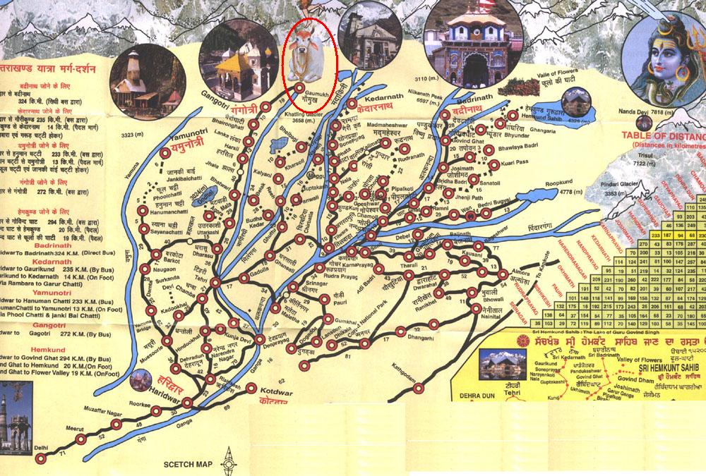
Uttarakhand Area Map
Sources of Ganga Map
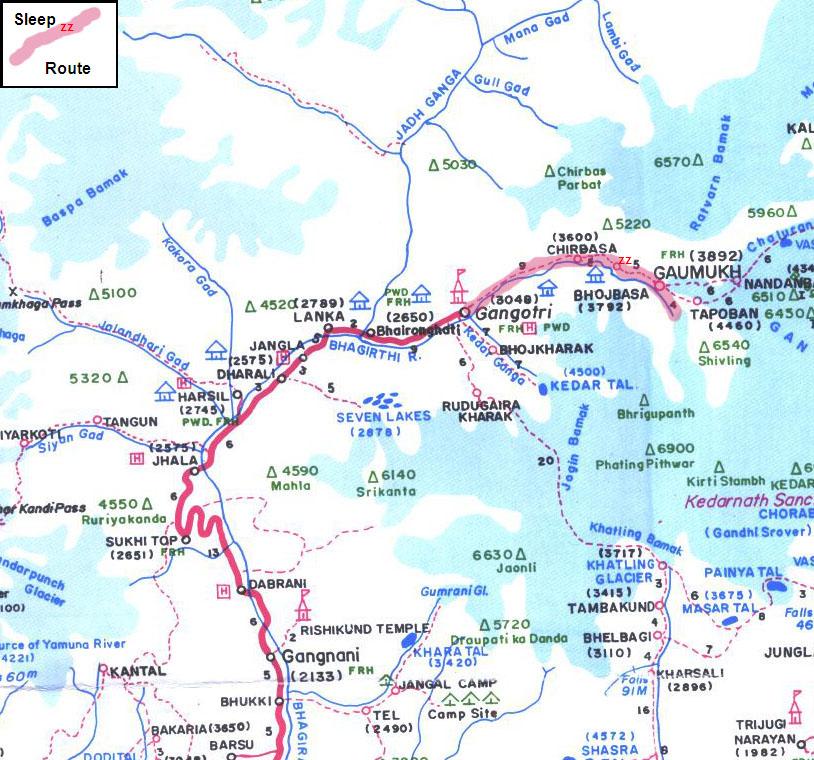
Gaumukh Area Map
|
Wpt #
|
Description |
Elevation (m)
|
Lat (N)
|
Lon (E)
|
|
1
|
Gangotri Village |
3057
|
30 59.607
|
078 56.480
|
|
2
|
Trail Head |
3080
|
30 59.681
|
078 56.528
|
|
3
|
Park Entrance |
3152
|
30 59.733
|
078 57.260
|
|
4
|
Pavillion w toilets & camp area |
3587
|
30 58.940
|
079 01.224
|
|
5
|
Pine forest above bldgs that may provide shelter. |
3607
|
30 58.804
|
079 01.463
|
|
6
|
Bajbasa (gov’t rest tents, restaurant, &private ashram) |
3800
|
30 57.071
|
079 03.053
|
|
7
|
Gamuk glacier |
3951
|
30 55.608
|
079 04.755
|
|
8
|
above glacier – junction of two trails |
3986
|
30 55.612
|
079 04.963
|
|
9
|
end of trail on north side (not Tapuvan side) |
4022
|
30 55.599
|
079 05.009
|
|
10
|
flags on south side that mark part of the Tapuvan trail. |
4092
|
30 55.546
|
079 04.869
|
|
11
|
On return, river crossing that may be the valley leading to Mt Safe, a 6k trekkable peak. Trail is beyond about 100m then cuts back up and into valley. |
3738
|
30 58.064
|
079 02.300
|
![]()
Total Cost Range of this Activity is: $
Details:
| Shared jeep transport (to/from Uttrarkashi) 2 nights Gangotri Village guesthouse (before & after trek) Permit free, park entrance + 1 extra night + camera fees Trek carried in food (3 days) 2 night ashram (meals supplied) |
$20 $20 $15 $15 $20 |
| Total | $90 |
2009 Prices
Return to Post


