

This post is about a simple Pontassieve to Firenze Day Hike using the regional train system in Italy. It all started a while ago when I discovered that I could put my bicycle on any regional train, commute to a distant local for a tiny fee and then ride my bicycle back to my starting point or jump on another train at any point and return in comfort.
Although I was not taking a bicycle with me on this day, let me rant a bit about the bike option. The Italian train network and the new regional train cars are spectacular. They all have bicycle cars (including special spots for electric bikes so that you can charge your bike while on the train).
And did I mention the price? Yes, regional trains are cheap by any European standard.  So what I did is what I’d done in the past, but less the bicycle. I picked a station about 15 km outside of Florence along the Arno river. I then used my Locus app to plot a walking route back to Florence (generally along the river).
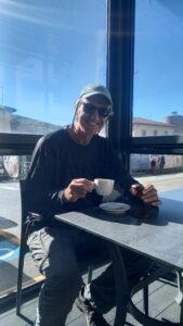
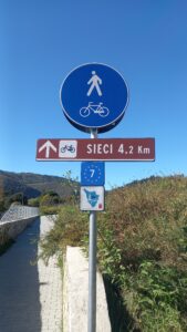
With the plan set I found a buddy, purchased train tickets to the spot (Pontassieve) and then we set out. Once in Pontassieve, we took advantage of the pastry/coffee shop located outside the station (all Italian train stations have pastry/coffee shops in or outside the stations). After coffee and a cake I whipped out my phone and we started following the gpx plot that Locus cooked up for us.
![]()
Total Cost Range of this Activity is: Free
Free, free and free (ok, there is the regional train fee of 5 Euros to Pontassieve and the truncated return fee of 2.50 Euros).
Start the Hike
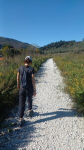
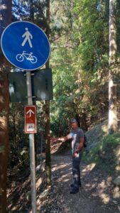
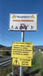
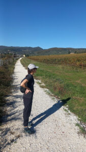
The route I followed took us through various landscapes which include small towns, forests, groomed bike/hike trails, hill olive groves, vineyards and yes, along the Arno River at times. But it was not all flat river banks. The Locus plot did show one 600m hump that I didn’t think would be an issue.
Lunch Break
At one small town the plot took us along the village’s main road and then turned up a side hill (mentioned above). With spectacular sunshine and what felt like the highest point in the river valley, we decided to stop for lunch in a small park with an old public water tap.

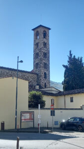


Refreshed and fed we continued downhill into and through more small villages until we finally settled into a long trail along the banks of the meandering Arno River. At this stage things did get a bit boring.
Along the Arno
After about an hour of riverside walking (Rovezzano) we were stopped by a sign indicating the trail was closed for renovation. The detour took us out into a long stretch of busy Florence suburb with lots of traffic and shops. Not the peaceful river and countryside we had been enjoying. 
We had covered 15 km in the past 4 hours at an average pace of 5 km/hour and decided to forgo the last 4 km into the city center. Accessing the big “G” I located the nearest train station (20 minutes away). We were guided there by the phone naturally, then purchased a 2.50 Euro train ticket and waited 25 minutes for our coach to arrive.
Shortly we were back at base and enjoying the Italian tradition of an Aperitivo. A wonderful way to spend random days hiking around Italy and enjoying their food and drinks. Cheers!
GPS Track
Download the Pontassieve__Firenze_Rovezzano.gpx track. Check out more GPS tracks.