

This is the Langtang Trek narrative. I provide details about my trek and the summit of Tserko Ri (5024m). For maps, costs, logistical requirements and facts visit the Langtang Trek blog post.
Narrative continued from the Langtang Trek blog…
I’ve a great deal of experience with Nepal’s hellish local bus trips, but even I was impressed and frightened by the 72 km ride that took 9 hours (rather than the normal 12 hrs) to reach Syabru Besi. Naturally the bus was jam packed both on the inside and on top. The first 8 hours were simply uncomfortable but then we reached the last hour of hairpin switch back on a dirt trail that snaked its way down the mountain valley to reach the last town and our trailhead, Syabru Besi. Half way down the face of the valley we all had to disembark as the bus inched its way around a stalled truck.
 We watched in awe as the dirt and stones crumbled under the buses outside wheels and it leaned precariously over the open expanse. Finally as the bus pulled around the stalled truck it started to rain heavily. We quickly fought our way back onto the bus, but this time with all the original occupants and those from the roof. Naturally no-one wanted to move all the way to the back of the bus in case it tumbled over the cliff, so we were all packed tight in the front half. We sweated, pushed, and cursed each other, in a heap of body parts for the next half hour until we reached the check post outside of town. At least at that point I managed to fight my way back to my seat and remove the interloper who had occupied it. Shortly after this stop bus unloaded its sweat covered and frazzled occupants in the heart of the one-road village. I had made friends on the bus with two westerner’s (Michael and Dianna), so we assembled and agreed to share accommodation for the night.
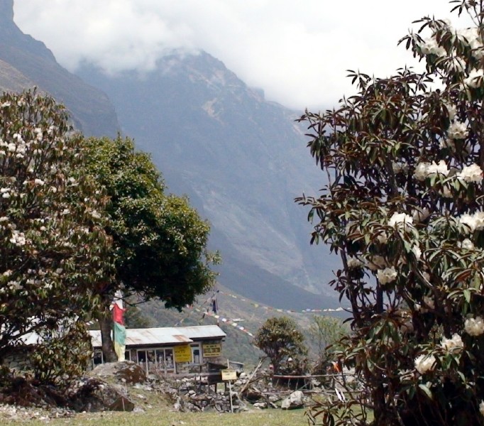
We settled into the Buddha Guesthouse and discussed our trekking options that night over dinner. The route followed the Langtang Khola (river) from Syabru Besi at 1450m to its glacier source beyond Kyangjin Gompa at 3900m; approximately three days walk to the northeast. Both Michael and Dianna agreed to join us and be filmed, however, we couldn’t agree on a pace or daily plan. Michael wanted to set a heroic pace; Dianna wanted a fast pace, while Kat and I wanted a leisurely pace. I cautioned them that it was foolish to hurry when on a trek because altitude and mountains should always be respected and further, what was the point in hurrying anyway? After some talk we finally agreeing on the next day’s objective even if we were all going to travel independently at our own paces.
Day 1
The next morning (day 1 officially) I woke early and found that Michael and Dianna had already set out. I enjoyed a full and slow breakfast, before setting out at 8 am at an easy pace. The day was sunny and extremely hot, so the constant up and downs through the sub-tropical forest was both beautiful and uncomfortable. I was soaked with perspiration within half an hour and then pestered constantly by swarms of Nats (tiny black flies). Around mid-day we stopped for lunch and a nap at Bamboo (three guesthouses at 2000m) and then continued along the steady up and down (but generally up) trail through Eucalyptus trees covered in hanging moss.
We reached the village of Hotel Lama (Changtanga) by 4:30 and agreed to stay at the Sherpa Guesthouse, not realizing that our target for the day was only half an hour further. The village was a cluster of about 8 guesthouses with one under construction, which means that laborers hammer on stones from sunrise to sunset. This turned out to be a free early wakeup call that I resisted unsuccessfully the next morning.
Day 2
After breakfast on day 2 we were informed by the owner of the guesthouse that he also owned the Buddha Guesthouse in Langtang (our day’s objective) and that it was new and that we could have free rooms if we stayed their. We agreed and set out around 8:45 am.
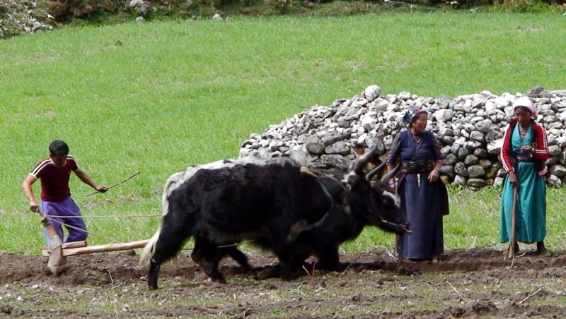 It was another long, hot, sweaty, bug infested morning of walking up and down, but generally up steep inclines. The scenery changed a number of times before our lunch/nap stop at Ghora Tabela, 3000m between mixed Eucalyptus, bamboo and rhododendron forests. After lunch the landscape became more settled, with cultivated fields and open pastures mixed with scrub pine at intervals.
The last hour of the day, before Langtang village, dark clouds moved in as the sound of thunder rolled up the narrow valley and intermittent raindrops fell. Fortunately the temperature dropped with these clouds. We picked up our pace and almost stopped a few times at the many scattered guesthouses that dot the trail before Langtang, but in the end we pushed on to make the day’s objective at 4:30 pm.
Langtang, 3514m, is full of guesthouses and it took us a while to locate the Buddha just as heavy rains began to fall. True to his word, the proprietor was waiting for us and welcomed us warmly with chi and a fire in the dining room.
At dinner we asked about Michael and Dianna without success, but we did meet a friendly Dutch couple and an Austrian man who was going to our next day’s objective of Kyangjin Gompa, and as it turned out another guesthouse owned by the same proprietor (who once again offered us free rooms).
Day 3
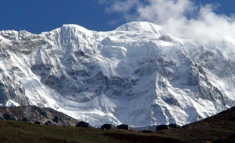
The day started out late like all our prior morning departures. We had a full breakfast and then set out on the short two and a half hour walk (that would take us four and a half hours) to Kyangjin Gompa at 3900m. The walk took us almost twice as long because the mountain views were spectacular along this stretch of trail. Plus the trail wound through a number of small scenic villages, included numerous mani walls and small chorten. Before Kyangjin Gompa we passed the massive Langtang Glacier and Kymoshung Ice Fall, located at the base of Mt Langtang Lirung, 7227m and Mt Langtang II (Ghenga Liru) at 6581m, to the left of the trail. There seemed to be an ideal photo opportunity around every bend.
We reached the village and the Nameste Guesthouse just past noon, so settled down for a solid lunch and then a liesurely afternoon of napping and wandering and acclimatization.
 That night, at dinner, we discussed our plans for the next day’s objective of summating Mt Tserko Ri, 5018m. The Austrian had two guides who insisted that he take an additional day to acclimatize since it would require a long 7 hrs that covered more than a thousand meters of altitude in order to reach the summit. The Dutch couple’s guide agreed that the girl could not attempt the summit due to serious foot blisters, but agreed that the boy was capable. In the end the Dutch boy, the Austrian man, and their three guides agreed to make an attempt the following day. We stated that we would follow them about half an hour after they left so that we could use them to point out the trailhead for us and so that we could set our own more comfortable pace.
Day 4
The day started out clear and cool. We finished breakfast and set out half an hour after the group left. Unfortunately we couldn’t spot them on the trail after clearing the hills to the east of the village and crossing the Chubi Chu tributary so we continued along the now tiny Langtang Khola river (mostly a white rocky flood plain). We kept to the high ground as much as possible in an attempt to spot the group and save energy. In time we came up parallel to the airstrip (a moss area marked by stones laid in a long rectangle). At this stage I knew we had somehow missed the trailhead to the north so we doubled back and to the north using steep yak trails. After an hour of backtracking we spotted four tiny trekkers to our northwest on a ridgeline with some stone hut outlines. We spent the next hour finding our own way up a deep gorge, cut by a small stream, until we reached the huts. Only later (on our return) would we discover that we should have turned to our left (north) after crossing the Chubi Chu tributary, and then climbed and followed the ridge line to the right of the tributary to reach this spot.
We were exhausted when we reached the abandoned stone huts so rested while eating some energy bars and trying to spot the previously seen four trekkers, but without success. We followed the now clear footpath as it wound its way up and along the steep ridgeline that paralleled the tributary and sandy gorge to our left (west). After a number of rests and an additional hour we reached a clearing and five more abandoned huts. At this point we spotted the four trekkers that we had glimpsed earlier. They had turned back and were returning in haste for an obvious reason.
Photos
The sun was still visible to our south, but now the mountain itself was completely enclosed in dark gray clouds. We waved to the returning trekkers as they passed and then took shelter from the cold wind in one of the huts to wait out the clouds. After half an hour we discussed our options. It was already 12:30 and it appeared that we were on a trail that was not on my map. Further, the mountain was hidden from view and I wasn’t sure if we needed to continue along the footpath to the north or if we needed to cut east across the front of the mountain (as shown on my map). We agreed to continue along the trail to the north and that we should set 2pm as our turn around deadline if we wanted to return to the village by 5pm. With a firm cutoff time established, we then set out north along the footpath.
The trail soon turned into a large boulder strewn expanse leading to the left (towards the hidden mountain) with scattered cairns at intervals to mark the trail. We continued through the boulders, then up a steep winding section in fog/clouds until we reached another larger boulder field. At this stage we were exposed to strong cold winds whipping up a narrow gap. This wind made us shiver with cold, but also blew with enough force to thin out the clouds and give us periodic views of the far off ridgeline that ran east and west across out route. Clearly our objective was to gain that ridge and then turn right and up the even steeper slope to the hidden mountain on our right.
By 11:45 pm we made the ridge and stopped to drink and eat another energy bar in the shelter of a large boulder. At this stage we saw our group from our guesthouse emerge from the fog. They had reached the summit and informed us that the slope was steep, covered in snow, shrouded in clouds, and then advised us not to proceed. They also admitted that they had also missed the trailhead turnoff at the tributary, which I found baffling since the group included the three guides.
We talked over our options and agreed that we would give the summit one attempt but would turn back if we felt it was unsafe. Further we informed the departing group to expect us back at the guesthouse by 5:30 pm and that they should send out a search party if we didn’t turn up. They agreed and then quickly disappeared into the clouds as they descended.
We set out quickly, but cautiously. Kat had some difficulty with her footing, and appeared nervous, but with a little encouragement and guidance (one of the few times she accepted advice) we managed to wind our way up the snowy slope for the next 45 minutes until we rounded a gentle bend and spotted the outline of the summit prayer flags in the distance. At this stage the snow thinned and the slope decreased.
The Summit
We closed the distance to the flags quickly and then hopped about happily on the summit of Tserko Ri (5024m) even though we couldn’t see much of the valley below. It was now 12:30 pm so we took some photos and rested, watching the clouds moving up the slope at breakneck speed. At 1:15 pm we stood back and took our final photos of the summit and then started the long and tedious return journey to the guesthouse.
We reached the trailhead at the Chubi Chu tributary around 3:30 pm and marked the turn off with some stone cairns as a service to future trekkers since even the hired guides couldn’t find this unmarked trailhead.
We reached the guesthouse by 4 pm happily where we enjoyed a large meal and an early night.
Photos
Days 5 & 6
The return journey to Syabru Besi took only two days (Kyangjin Gompa to Lama Hotel, and then back to Syabru Besi the following day) where I negotiated a 1000 rs per person shared jeep ride back to Kathmandu the next morning.
While in Syabru that last night we ran into Michael again. He informed us that he had injured his kneed on the second day so had not even gone as far as Langtang. I laughed and recalled the old fable about the tortes and the hare. Slow and steady winds the race it seems.