

This is my Kayak from Miami to Key West trip narrative. I provide details that include maps, costs and photos on the associated how-to post. This is a self-guided 11 day adventure on a shoestring.
Kayak from Miami to Key West Summary Route
- Day 1 Start at Miami River and free camp in tent at Coral Bay Point (on Biscayne Bay)
- Day 2 Cross Biscayne Bay and free camp at Black Point Park (on a picnic table)
- Day 3 Early start, pass Turkey Point Power Plant (Private Property) and free camp in Card Sound
- Day 4 Cross Card Sound but trapped in Barnes Sound by weather (sheltered and free camped in hidden Jewish Creek canal)
- Day 5 Start at Jewish Creek and end on South side of Tavernier (free camp on beach)
- Day 6 Free camp in Lower Matecombe
- Day 7 Coco Plum Beach free camp (before Key Colony Beach)
- Day 8 Early day ending at Knight’s Key (next to 7mile Bridge) due to winds. Camped at Knight’s Key Camping (paid site).
- Day 9 Seven Mile Bridge Day. High North winds again. so rest at Pigeon Key, then cross Bahia Honda Channel and finish at Big Pine free beach camp.
- Day 10 Summerland Key, Cudjoe Key, Sugar Loaf Key,Sugar Creek and then free camp under MM13 highway bridge.
- Day 11 Made it to Key West and met by the Welcome team (Jeremy & Scarlet).
Kayak from Miami to Key West Narrative
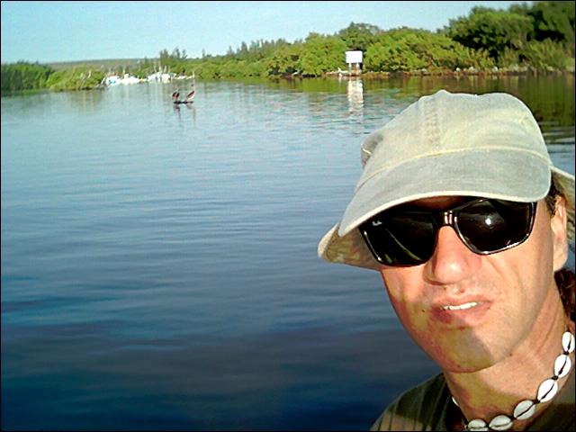
Day 1, December 31, 1992, New Year’s Eve
Day 2 Day 3 Day 4 Day 5 Day 6 Day 7 Day 8 Day 9 Day 10 Day 11
It seemed like a good day to start a new adventure. In some cultures they say that the first day of the New Year sets the tone for the rest of the days of that year. I felt that I had better get the adventure under way if I was going to catch that first day.
I drove the kayak down to Sewell Park, on the Miami River, just north of NW 17th Ave and east of the Dolphin Expressway. This little park was once a large private residence in this small closed pocket of a neighborhood. I unloaded and locked the kayak to a fence post with a bicycle lock and drove to the house to collect the remainder of my supplies. I asked one of the house-mates to drop me at the park on her way to work. She agreed. I was now committed to the journey.
I was dropped at the park at 9:30 and by 10:30 I had the kayak packed. I took a few photos and then castoff downstream towards the open Atlantic. Paddling in the Miami River is a pleasure. The river is narrow (one hundred meters at its widest) and well dredged. Boat traffic is heavy but the entire area is a No Wake zone due to its commercial nature. Being on the river provided a unique perspective to the area. I’d driven over every bridge on this river over time yet had never once realized how many of them there where, nor the winding nature of the river. Many of these bridges are in a sorry state when viewed from beneath and the seawalls and rotting docks attest to the years of commercial activities and neglect. The river then wound its way through the heart of downtown Miami. I gazed about, neck craned, from the tiniest of perspectives at the towering buildings and frenzied motorists above.
Clearing the Miami River ended my leisurely start as heavy winds slammed into me and set me paddling simply to keep the kayak from being blown over. This stiff east wind was the norm for the Miami beaches. It’s a pleasant and refreshing wind most of the time but in a kayak it is far from refreshing. I tried to make a sharp south turn to the right but this put me abreast the wind and the high profile of the kayak (myself and my gear strapped to its surface) caused me to almost topple over. I had to tack the kayak to the southeast, with the bow cutting the waves at an angle in order to make a safe southern course. I angled onto the lee side of Claughton Island, which provided some shelter and needed respite. This was ridiculous since only an hour had passed since I began and I was already quite tired.
With the protection of the island I was able to make steady southern progress. I was still finding the going difficult due to the depth of the channel under Brickell Key Drive, and the winds gyrating between the high-rise buildings. The seas were what sailors call, “confused” with swells of two to three feet. Steady swells aren’t a problem for most boats, but confused swells while in a small kayak make for the equivalent of a bronco ride. Things didn’t look much better when I cleared the south tip of Claughton Island. The full force of the wind struck my port side and drove me toward the shore.
 I kept a southeast tack into the wind while being driven to the west. This is an old trick that most boaters understand. You may point your boat in one direction and go straight and still end up in a different place due to the wind and currents. So you compensate by aiming into the wind or current slightly. This method put me at the tip of the Brickell Bay Drive where the coast begins to curve to the west. Essentially I was heading south by west until I could clear the south bend of Florida and start heading in a westerly direction to along the Keys, with a slight south inclination. With these strong winds out of the east my trip would be a breeze I though.
By 12:30 I reach the turning point where the Richenbaucher Causeway heads almost due south and the shore curves westward (essentially a 50 mile bite). The Alice Wainwright Park is located along the west bank of the causeway. The park is another of the old estates that have somehow been spared from developers and fallen into the hands of the city parks department. The park is fronted by a sturdy seawall, which acts as a break against the constant pounding of the Atlantic surf. There are no mooring facilities so finding a place to beach was difficult. I managed to time my jump from the kayak to the seawall (amid numerous rocks) and spent the next hour snacking on peanuts and granola bars and napping in the warm rays of the sun. The last day of 1992 was looking like a fine day at this point.
When setting off I noted that the wind appeared to have changed directions. It seemed to be out of the east to southeast. I didn’t realize that it was actually being whipped around the curve of south Florida so it would seem to be at my back or my port side as I paddled in a southwest direction the rest of the day. I felt this an unfair turn of events given my struggle in the face of the wind all morning, only to be pestered by it now that I had made my turn. But little did I know that the weather was turning in a much bigger way. I would look back on this day as easy compared for what lay ahead.
By 2pm I was casually paddling past Mercy Hospital (how do hospitals get such prime locations?), Fair Isle, and then through the Coconut Grove marina area. This area is a beautiful South Florida setting with condo high-rises along the palm-strewn beachfront and countless sailboats moored at marinas and anchor points. It is a virtual floating community with numerous luxury vessels mixed in with home-brew sailors that appear involved in perpetual re-fittings. I made my way in and out of the maze of boats and small islands that never seemed so prevalent from the shore. I stopped to rest and snack on a small spit called Tidal Flat, across from Kennedy Park, and then proceeded along the shore on a southwest coarse, passing between luxury homes and a number of small spits (Dinner Key and the Barnacle State Historic Site), the Dinner Key channel and numerous small wrecks and obstructions that reached out of the shallows at haphazard angles.
I cleared the Grove area and then the coastline turned south again. I was now deep into the residential bay area along the Coral Gables waterway (Sunrise Harbor) and approaching the Matheson Beach/Park area. I had never been to this part of Miami, even though I drove past it each day to and from work many years ago. The park and surrounding area are beautiful and spacious. I rested and took advantage of the public facilities before continuing on my way around 3:45pm.
I was beginning to get concerned about my travel time. I knew that most of the coastline in the area was civilized (settled and in private hands) so my choice of camping locations would be severely limited. I estimated that the sun would set around 5:30pm, so I had better pickup the pace if I wanted to find an isolated spot for a camp.
I had been observing the nature of the small hammocks, islands and spits throughout the day with an eye for possible camp sites. These spits were mostly collections of mangroves with roots sunk into the shallow water. At low tide the mud flats were exposed but at high tide the entire root structure were submerged in one to two feet of water. They appeared to be land from a distance, but upon closer inspection they were all simply trees growing in shallow water. Camping on islands was going to be more complicated. I generally carry a small jungle hammock, which would have been ideal in this situation. But naturally, this was one of the rare trips in which I didn’t bring it along.
I passed Chapman Field Recreational Area/ Matheson Hammocks as the sun started to take on a golden hue and lean towards the horizon. Around 5pm I reached the Snapper Creek Canal entrance. The area is a natural habitat called Snapper Creek Park with a narrow outcrop (maybe twenty meters wide) that extends into Biscayne Bay about two hundred meters and sits less than a meter above sea level high tide. Directly to the south of this outcrop sits the very exclusive mansions and slips of the Coral Bay area. This one small outcrop, before the expensive neighborhood, provided the most likely camp area under the circumstances.
I beached the kayak and walked the area in search of a camp area and also to determine the likelihood of being disturbed. The important thing to remember about “air camping” as the British call it, is that you have to camp late in the day and leave early in the morning. The likelihood of being discovered decreases the later you make camp and the earlier you break camp. Leaving zero impact on the camping area also helps because it doesn’t draw the attention of property owners or the authorities. In this case these rules didn’t apply. I knew I was basically still in the heart of the Miami suburbs (wealthy suburbs at that) and this particular outcrop was covered in discarded trash, bear cans, broken fishing tackle and fire pits. A clear footpath also made its way from the tip of the outcrop back towards the shore. Obviously numerous people used the area to fish and drink beer. How many people go fishing on New Year’s Eve I wondered? Not many I presumed.
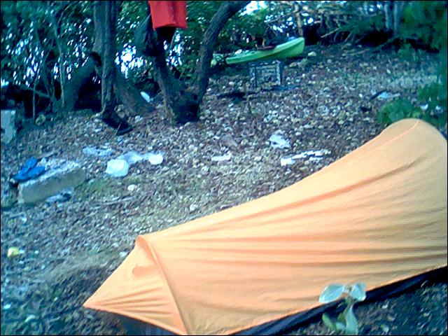
I set up my one-man tent about fifty meters from the tip and just off to the side of the footpath. I could still see the outline of Miami’s South Beach condos on the horizon as I sat on a stump, on the outcrop, and ate a cold can of baked beans. By 6pm I was in my tent and sound asleep. I was awakened around 10pm by the sound of people approaching and the shine of flashlights. Spanish voices encircled my little tent and then proceeded on towards the tip of the jetty. After a while I crawled out of my tent and went to see what was about. I could see the outline of five or six figures as a large fire blazed. I approached the group casually. The group of young Latin men seemed puzzled by my appearance, but was more interested in the fishing and beer drinking than me. They offered me a beer, which I declined, and I settled down to watch them fish.
The fire burnt down to an ember, the beer ran out and the fishing died off by 11:30. They gathered their things and were off as swiftly as they had appeared. Obviously they had ventured out for some quick fishing before continuing on to late night celebrations. I returned to my tent and a sound sleep in no time. Again I was awakened, but this time by the sound of far off explosives. I returned to the point and observed far in the northeast Miami’s South Beach fireworks. The light show was outlined by the high-rise buildings and the time-delayed sound of explosions reached me noticeably after the visual queue. I sat on the old stump, smiled and reflected on the fact that I was alone on an outcrop of coral, on this new night of the New Year. For the third time I returned to my tent to rest, for I knew tomorrow would be harder on my already sore body than this first day had been.
Day 2
I awoke at 8:30 to a very cold morning. It had rained briefly during the early morning hours as a cold front blew through, but it was now sunny and I was sure that the day would heat up (especially if I was constantly paddling). I broke camp and was off within 10 minutes. I didn’t feel like eating (and all I really had to eat was more granola bars anyway) and determined to clear the Miami suburbs by the end of that day.
I calculated that I had only made about 10.3 miles (as the crow flies) the previous day. At that pace I would take me twenty-three days to reach Key West. Obviously I would need to pick up my pace or this was going to be a very long kayak trip.
The winds had dropped off overnight to approximately 5 knots out of the southeast. While not strong, they did present a bit of a problem when they turned more south than southeast. A change seemed in the making and the wind continued to shift back and forth throughout the day.
I cleared the Coral Bay homes easily and began to struggle into a large open lagoon area south of the Chapman Field Recreational area. The wind was a constant bother and kept pushing me westward and northwest towards the shore. I aimed for Chicken Key (a straight shoot southwest) but was blown too far west and towards the Charles Deering Estate. I was already exhausted but was determined to make it to the lee side of Chicken Key before stopping to rest. Actually I didn’t have a choice. The wind would have pushed me into shore if I’d stopped before the lee of the key. I finally made it to Chicken Key’s shallows.
No Trespassing and Private Property signs were posted along the entire circumference of the island. Curious about this sizable key sitting pristine in the middle of this bay (and the numerous posted signs), I decided to take a look around. I paddled around the entire island and found a few suitable openings in the thick mangroves. These openings were plastered with even more discouraging signs. I figured I could always claim an emergency if I was somehow apprehended on this forbidden knoll. I beached my kayak and made my way inland. This key actually contained solid ground (extremely rare), with an elevation of up to three feet in places. However, a large part in the center fell away into a shallow swampy area. The circumference was laid out with survey stakes and strips of orange marking tape. It appeared as though this key would soon become one more private island. My primary objective in surveying the key was to determine if it was suitable for camping. This would hopefully give me some solace as to my future camping prospects. The entire time on the key I felt uncomfortable. A feeling of being watched or in violation of hallow ground pervaded the air. Perhaps it was simply the ominous signs posted all about the island. In any case, I was happy to be on my way.
I set off southwest from the south point of the key to hug the shoreline along the large open water of Biscayne Bay. The coastline here is banded by a narrow natural habitat of mangroves, bugs, birds and swampy smelly shallows (averaging less than a meter). The shallows gave me a bit of a challenge, but all in all, the area was picturesque and quite old worldly. The entire area was not navigable (as evidenced by a number of partially submerged wrecks) and protected from development by the Biscayne National Park boundaries. The bay is so large at this point that it gives the impression of the open sea. However, it is sheltered by a barrier of shallows and spits approximately ten miles offshore with names like Safety Valve and Soldier Key.
The afternoon was truly enjoyable as I paddled through the shallow waters, with the sun shining, and countless numbers of strange birds sighted. This was how I had originally envisioned the trip. The first day of the New Year was shaping up as a fine day to use as a benchmark for the following year.
I stopped at an old wreck stacked with a few packing crates and tied off flotsam. These were perhaps created by local fishermen as bird platforms, but more likely by local kids with time on their hands and perhaps a desire to build a secret floating fortress. In any case, it seemed like the perfect location for a snack and a short nap. The breeze was light enough to be refreshing and to keep the bugs at a distance. It would take a mighty strong mosquito to fly across the 100 meters of open water to reach this comfortable perch.
I took a short nap, awoke to the squawk of wadding birds and realized that the tide had continued to drop. I needed to set off quickly before I got
stuck in one of these shallow dead-ends that littered the coastline. Since entering the Bay I had been keeping a keen eye on the water depths ahead of me throughout the day to avoided shallow dead ends. The secret was to watch for tiny sea grass sprouts sticking out of the water. At high tide this grass is completely submerged. But as the tide drops it begins to emerge above the surface until it becomes completely exposed. At that point even a kayak can’t proceed any further.
Another sign is the wading birds. Since much of the area is very shallow (less than a meter deep) wading birds are always about. When the water level falls below their kneecaps one needs to pay particular attention to the route. When the water level is around their ankle joints one need to seriously find a route to deeper water or may need to double back a few thousand meters, or worse, have to get out and drag the kayak in knee deep muck. Finally, in some places deep troughs run along the shore just outside the mangrove root areas. I didn’t know if these were man-made trenches or a natural condition caused by waves that breach the outside barrier during storms. In any case, to make forward progress I had to maintain constant attention to water depths.
I set off from my little man-made structure around 3pm and continued my steady march to the south. By 5pm I began to worry about my camping situation again. No more islands or structures presented themselves as potential campsites and the sun was fast setting. My charts showed a long structure extending out into the bay at Black Point, the mouth of Goulds Canal. The chart also showed a park, marina, and boating facilities, but no camping area. I paddled harder in hopes of reaching this outcrop before dark. Around 6pm as twilight faded to darkness I reached the tip of this long jetty. I beached the kayak and began a long walk towards shore. The jetty was a very narrow strip of coral topped with a one meter walkway. All along its sides ran boulders and breakwalls.
A second jetty ran to the south, but only a third of the length of the northern section. In the middle a narrow deep channel ran into a comfortable marina with slips and boat launch facilities. The park was open twenty-four hours a day and manned by security at the marina area and fisherman in the general park and jetty areas. Camping here was going to be impossible, but at least I had nice bright and clean bathroom facilities.
A local fisherman informed me that a small shallow channel ran inland where the north jetty reached land. This lead up a twisting channel to a gravel beach area designated as a kayak launching area. I returned to the kayak and paddled up the channel in the darkness to the eerie sound of night creatures and the occasional croak of an alligator. I beached the kayak under some overhanging branches and unloaded my sleeping bag and another can of baked beans. I then walked to one of the picnic table shelters that are commonly used for barbecue or birthdays in parks all over Florida.
I found a location that wasn’t too badly lit by the overhead lighting. I ate my beans, tossed the empty can in the trash next to me and then lay down to sleep on top of the picnic table. Sleeping on a wooden picnic table isn’t all that different from sleeping on a hard floor or rock surface, so I didn’t find it too much of an inconvenience. However, my eyes hadn’t shut for very long before I was startled into wakefulness by a crashing sound next to my sleeping location. I sat up to find a fat raccoon deep in the metal trash rooting around for my discarded tin of beans.
I chased it away but it kept coming back after I settled down to sleep. Soon its relatives joined us in this standoff. The relatives then began getting busy with the other trash bins. I finally emptied all the bins into the one furthest from my area and stacked all the empties like paper cups into each other. It would take a Hercules of a raccoon to lift six large heavy county trash bins in order to reach today’s discarded trash. Obviously these raccoons thought they were capable. I gave up and tried to sleep while the raccoons continued to make a racket and struggle with the trash bins.
No sooner was I finally comfortable and on sleeps threshold when the wind died down and the mosquitoes came out for dinner. Discouragin
g them was as vain as my attempts at discouraging the raccoons. Obviously the creatures of this county park were used to getting what they wanted. With the wind gone I found it very hot in my sleeping bag and my face buried in a t-shirt. But outside of the t-shirt and sleeping bag the mosquitoes had their way with me. It was a tiring night of uncomfortable short naps.
Day 3
I was up by 7am when the sun first broke through the northeast barrier of trees fronting the picnic area. I took my time this morning and used the luxurious facilities. This was the morning of my third day and already I was seeing the wonder in man’s white porcelain inventiveness. I took a sponge bath in the sink, shaved and basically relaxed for a bit. No raccoons or mosquitoes were bothering me at the moment and I had found a Pepsi machine that dispensed cold, refreshing liquid at a reasonable price. Anyone who has camped for any length of time knows how simple pleasures can grow to huge proportions after only a few days. This was how I felt about a cold refreshing Pepsi on that bright and languid morning.
I set off around 9am determined to pickup the pace. I calculated that I had made 10.1 miles, as the crow flies, the previous day. That was less than my first day of paddling. Obviously I was in need of some improvement if I planned on finishing this trip in a reasonable time.
I set off due south with extreme sunshine and a flat bay. I felt a little tired from the restless night, but physically ready for the day. An ironic twist concerning my lack of adequate camping appeared in short order. Traveling due south I passed a number of canals and then notice two tiny dots on my charts. The charts indicated two spoil areas just off the entrance of the Mowry Canal (just north of Convoy Point). I approached what appeared to be full-fledged islands with beautiful camping areas under towering pine trees. They must have been man made from the canal dredging, as they seemed completely out of place and character. They reminded me of islands in the Canadian north rather than shallow tropical spits. If I had only paddled another 4-5 miles south yesterday afternoon I would have been able to camp at this picture perfect location. But then again, 4 or 5 miles was about a half day of paddling at my current pace.
I did some simple math that morning and I found that it taken me about two hours to cover this 4 or 5 mile range. So today’s average pace was 2.5 miles per hour. At this pace I would cover at least 20 miles in a day. However, I knew from previous bicycle trips that I seldom kept my morning pace all day. Nor did I travel continuously. I preferred to take regular breaks every hour and even an afternoon nap from time to time. But in spite of these limitations, I felt I should be able to improve upon my daily 10 mile average.
I stopped to take some pictures of flats fisherman and large Turkey Vultures perched in the high recesses of the pine trees and then continued south towards Convoy Point. There I discovered an oasis that didn’t appear on my small-scale charts. The Homestead Bayfront County Park had public facilities, a general store, marine exhibits, canoe and kayak rentals, and even diving/snorkeling trips to the outer reefs.
The sun was out, the temperatures were in the high seventies and I felt a need for better sunglasses. The general store had numerous cheep sun glasses with polarized lenses. This was exactly what I was looking for, although their supply of food stuffs was lacking. I had recently lost my polarized marine glasses in a Jet Ski tumble and had failed to pickup a replacement set. The pair I had been using in their place was fine for land use, but any fisherman can attest to the value of polarized glasses at sea. With the new glasses the world below the surface became would become visible.
I rested, snaked and lounged around watching the tourists for a while and then set off again. My kayak, laden with gear, and my salty appearance gave the bus full of Japanese tourists something to take pictures of and their attention strengthened my resolve to make it to Key West by the brute force of a paddle.
I progressed south for another mile until I was directly off the shore of the Turkey Point nuclear power plant. The coastline here was posted with serious “No Trespassing” signs and I felt as though I was under surveillance the entire time I paddled along shore. These were the edgy days after September 11th, and everyone in a position of authority seemed to be walking on egg shells. So I took some quick photos and continued on my way without even considering a closer look.
 The coastline then began to curve to the east and I had to head progressively further to the southeast. I could see land to the southeast and knew that I would be turning south into more protected water so I wasn’t concerned. I was aiming for Mangrove Point, from which I would dogleg south through Midnight Pass and then into Card Sound. I considered Card Sound to be the first part of the Florida Keys. North of this point you are in the Biscayne National park and bay, south of this point you are adjacent the north key called Key Largo. I made the point and the turn without incident and then faced the dark enclosed waters of Card Sound.
It was getting late in the afternoon and I was beginning to wonder about a campsite. I had made it far enough south that I wasn’t concerted about civilization. The entire coastline in this area is true Everglades and completely uninhabited. The only major occupant is the Turkey Point power plant and its huge cooling canals and basking manatees. But the Everglades’ shoreline lacks any solid ground and this area was no exception. I aimed for the cooling canal entrance at Cold Key Point since I knew that the canals had been manually dredged and most of the extracted coral base would have been dumped next to them. Around 5pm I sighted the first of the two canals. And as hoped, the shore area next to each canal was solid, about 10 feet high, flat on top and covered in pine trees. I had found the location of my third campsite.
I beached the kayak and made a survey of the area by foot. A dirt service road extended the entire length of the canal and disappeared into the swamp horizon. I found a clearing along a side road that appeared unused. The ground was covered in a 6 inch deep layer of pine needles and ideal. However, I was having a difficult time with the mosquitoes and “No-see-ems” or Sand Fleas. I had applied an ample coating of my secret bug repellant but the bugs didn’t seem to take notice. I was probably the only meal for 50 miles in any direction and they were not going to forgo the meal under any circumstances.
I setup my tent and started a fire as quickly as I could with on hand while the other constantly swatted at bugs. I changed into my light fishing pants and zippered jacket to no avail. The bugs were determined.
My food supplies had diminished so that night’s meal was a can of Spam and a can of beef in tomato sauce. I couldn’t wait for the cans to heat up since the bugs had started their dinner early. I even threw wet moss on the fire to smoke the entire campsite out (a trick I had learned in the Canadian wilderness) to no avail. I then wolfed down my warm grub and crawled into my one-man tent. Naturally all the bugs that were sitting on my body crawled in with me. While it was comfortable in one respect lying in the cozy tent on the other hand I was still getting bitten by bugs. I kept turning on my flashlight and killing hordes of them. I was baffled by the continued onslaught; they couldn’t have been reproducing at that speed so. My little cocoon tent didn’t lend itself to a lot of mobility so I made a number of awkward attempts to find the secret bug access point. I eventually slept at short intervals. Some time in the night I was awakened by raindrops. I got out of the tent and unrolled the fly only to crawl back in with more bugs. It then started to rain. I simply rolled over and buried my face in a smelly t-shirt and went to sleep.
Day 4
I awoke to a steady drizzle and a tent full of fat blood filled bugs. At least they were now easy to see and squash. A quick look down at the foot of the tent revealed a small hole in the bug mesh. Not a very big hole, but big enough for desperate bugs to use. I shoved a loose article of clothing in that direction and the bug entrance was temporarily closed. I spent the next ten minutes squashing every bug in the tent while I contemplated the approaching day. I could simply lie in the tent and wait for the rain to move on or I could break camp and get wet. Since I was generally wet most of the day anyway, I figured I might as well get out of Dodge. The less time I spent with these bugs the better my life would be. I also did some math with my charts and figured that I had traveled around 14.1 miles the prior day. Things were beginning to improve in the paddling department at last.
I exited the tent and broke camp in the pouring rain. I no longer owned any dry possessions. The process of breaking camp when you have a tiny one-man tent is not the same as when you have a normal tent. None of the packing steps can take place in a nice dry tent when it is the size of a cocoon. So everything was rolled up in a haphazard fashion in the rain with the anticipation of a drying spell later in the day. That was naturally wishful thinking since the weather didn’t clear, but rather got worse as the day progressed.
I set off on a southwesterly course around 8pm with a swarm of bugs in tow. The bugs didn’t seem to be put off by the downpour. It must have been a desperate time for these tiny little creatures to venture out in weather that was the equivalent of Buick’s falling from the sky to them. But the chance at a blood filled human must have seemed worth it, for they were out in full force. I paddled straight out a few hundred yards before the last of them either fell behind or found a safe perch on the kayak.
I paddled southeast through the Card Bank as the weather began stabilizing (the rain stopped and the gusts fell away to a steady wind). I followed the channel markers through Little Card Sound towards the Card Road Bridge on the horizon. I was beginning to get hungry and was hoping to find a snack shack near the bridge. From a previous car trip, I remembered that a manned toll both was located at the north end of the bridge and some ramshackle boat houses were parked along the canal that sits on the west side of the one land highway.
I tied the kayak off under the bridge and made my way to the toll booth on foot. The attendant told me I could find a restaurant up the road a short distance. I returned to the kayak and dug out some wet money and then proceeded up the highway on foot with visions of a hot meal dancing in my head. At 11:30am I found myself seated in the empty open-air waterfront Alabama Bar & Grill. The staff was in the process of opening up the grill for the lunch crowed so I placed my order of hot chili and fish & chips and settled down to wait with a cold Pepsi. Surprisingly the place began to fill up within a few minutes of noon. Johnboats began to tie off at the floating dock and cars began to fill the parking lot. I guessed that the food must have been very good or that this was the only restaurant in the area. The truth was a little of both.
I settled down to a long and languid meal while watching the weather turn. It looked as though the sun was winning and the clouds were beating a hasty retreat from a brisk north wind. It seemed to me that this north wind was the leading edge of a cold front. Once the leading edge of a cold front clears an area it tends to leave clear skies and windless days in its wake. So a cold front might be a good thing. On the other hand, I didn’t have any cold weather gear. I knew from prior experience that even the Keys could get cold in the winter, although only for a few days at time. But a few days would seem like a very long few days if I were shivering the entire time. I also knew from experience that I could handle most cold conditions if I kept moving, and paddling constituting movement in this case. Nights would be another matter entirely. My sleeping bag was a good mid-range down filled cocoon that would be fine if it stayed dry (but was wet from the mornings packing).
I finished the lunch and noticed that quite a few people in the establishment had noticed me and where stealing glances in my direction. I wondered if I smelled or looked that disheveled. Perhaps three nights of sleeping out, paddling in salty conditions, a lack of a shave and wind blown hair might make me look a little ruff around the edges. It made me smile and feel a little better about the adventure. At last I was far enough into it to know that I wouldn’t turn back and that I was capable of making it to the far off end. Little did I know that I would be staring at a different end in a few hours and wishing desperately to be back at this comfortable spot?
I refilled my water bottles from a garden hose on a wall facing the parking lot and then made my way back down the road to the waiting kayak. The wind was gusting from the north and the sun continued to play in and out of the clouds. At least it had stopped raining and my cloths felt only slightly damp. My tent and the rest of my belonging would have to dry out this evening when I made camp. I exited the bridge from under the north side, leaving Little Card Sound and entered the larger and open Barnes Sound. I would have to paddle 5.5 nautical miles if I followed the channel markers and made my way directly across the sound to the entrance of Jewish Creek. However, that option was impossible with the prevailing north wind. I could try to skirt the sound along the north shore, but it was such a haphazard shoreline that the distance would more than double. The southern shore looked fairly consistent though, and from what I could see, it was crested by mangroves. I knew the wind would keep forcing me to the south and into the mangroves, but I figured I would simply tack back into the wind from time to time. Plus I hoped to find safe landings to rest if I needed. At least that was the plan when I set off.
Almost immediately I discovered that the strong wind I’d been experiencing was actually tempered by the northern landmasses. As I made my way out into the sound the wind continued to pick up until I was paddling in one to two foot swells with white caps blown off the wave crests. I realized that I had paddled too far out to make it back to the shelter of the north shore. My best bet was to paddle at an angle just south of west. If I paddled west the waves would simply roll right over the kayak, soaking me and all my belongings, or worse rolling us over completely. If I kept the bow of the kayak just south of the line of west-east rollers I could almost surf the crests. I had to watch every wave with complete attention in order to sink the paddle at the appropriate moment to counter the kayak’s tendency to pivot with the wind and wave to prevent our top-heavy combination from rolling. The power stroke on each wave took enormous energy, the constant attention to each breaching wave, and the occasional rouge wave, took its toll quickly. Within half an hour I was exhausted and approaching the south shore much too quickly. I searched for shelter and a respite, but the shoreline was a solid wall of mangroves and crashing waves. Landing the kayak in those waves would be impossible since mangroves grew with tangled root structures that extend beyond the top of the tide line. The kayak would be tossed, I would be impaled on roots, and we would both be pounded to shreds in short order.
I turned the kayak back into the waves and tacked this time with the bow just north of the east-west line of waves, making my way slowly back out into the sound. It seemed as though I was sitting in the same position and if I stopped paddling even for a moment I would be washed backwards towards the mangroves. The sound of the crashing waves and the wind whistling through the mangroves gave me renewed strength and I slowly inched my way back out into deeper and darker waters. When I couldn’t paddle another stroke I turned the bow slightly to the south and focused on riding the wave crests in a south-westerly direction, applying timed power stokes. Before long I was once again in confused seas with the sound of the crashing surf all about me. I had been pushed back into the mangroves very quickly. I stole a glance at my chart and saw that I was past the mouth of Steamboat Creek and that my next possible shelter was a man-made canal that cut into the mangroves 2.5 miles ahead. Turning back to Steamboat was impossible given the wind and the waves and going forward was just as daunting. I had no choice but to continue in the current direction, beating into the wind and then surfing diagonally with it. This approach would eventually get me to the canal opening, but I seriously doubted that my strength would last that long.
My progress was painfully slow and the sky was now starting to grow dark with storm clouds. The cycle of surfing with the wind and then beating into the wind continued with painful regularity as I momentarily lost myself in the drone of the wind. A large rogue wave then crashed into the kayak broadside. I felt my heart jump into my throat as I tipped forward and the white foaming water raced over me, my possessions and the kayak. Miraculously at the last second I managed to sink the paddle into the trauf and force myself and the kayak up ever so slightly. This slight resistance was enough to keep us from rolling over completely as the wave continued on its vengeful way. I was soaked though with cold water and chastised my self for not paying attention. I realized that I was doomed if a wave washed me into the pitching seas. It then began to rain in earnest.
I was sitting on my children’s collar life vest and was in no position to stop and jiggle it out from under me and then tie it on securely. Any break in my paddling or attention would immediately put me and the contents of the kayak into the sea. It was also doubtful that I could hang onto the tossing kayak if I was tossed out in this tempest. I even considered letting the kayak run aground among the mangroves and then simply sitting it out in a tall mangrove. But my belongings would be pounded into pulp and I would probably freeze to death during the night. And the chances of being spotted by a passing boat were slim to none. The heavy rain had chased away any and all marine traffic.
I resolved myself to the battle and the on-coming waves as time slowed down to painful strokes and numerous close encounters with the goddess of the seas. These fateful encounters left me in a state of exhausted resolve. I resolved to fight until I could fight no longer and then I would simply let one of the three Greek mythical sisters of Fate cut the string. At this low point I noticed a small opening in the mangroves. With growing disbelief I steered the surfing kayak in that direction. As I approached I saw that some sort of sheltered channel ran along the shore just inside a barrier of outer mangroves. The small opening in this barrier was perhaps three feet across. I knew that I would only get one chance to breach that opening.
If I failed to hit the opening as a wave crested through I would probably crash into one of the submerged roots and be pounded into the trees by the relentless surf. I lined up my approach with what little reserve I had and simply let Neptune guide my green plastic vehicle. I had no energy reserves and was too tired to be as frightened as I should have been under the circumstances. As I approached the gap I saw that indeed numerous roots guarded the breach. My kayak would not normally have been able to clear the entrance but I was determined to find the wave that would make it a possibility. Back paddling desperately to hold my position for an oncoming wave I noticed that a strong under tow existed. The kayak coasted back further than I had anticipated and then a mighty wave picked us up and drove us forward. The water boiled and foamed all about me as branches from the encroaching mangroves slapped at my face. I was beginning to clear the gap and a smile grew on my salty lips. But then the undertow took hold and began to draw me back as the water level receded. I feared becoming hung up in the roots or simply being pitched over in their tangled picket. I sunk my paddle into the receding water and paddled for my life with a reserve I didn’t know I possessed. At the last moment just as I felt the kayak begin to scrape along the root base and pitch a second wave washed through the gap, picked us up and carried us into a body of calm black water about 30 meters across.
I slumped forward and simply breathed deeply. I was spent and cared nothing for my wet and wounded state. I was safe and that was amazing enough to keep me going for a while longer. I felt the kayak nudge up against something solid and heard the slap of water. I looked up and saw that I had drifted onto the south shore. Small waves were slapping the sore with what remained of the large three footers crashing through the outer mangrove barrier. I turned to watch as wave after wave of white water crashed through the trunks and lower branches of the outer barrier to reach this secluded channel as small leisurely waves.
A small opening in the mangroves revealed itself a little way from my current position and I made my way over to it, beached the kayak and crawled out onto the shore. The shore was a mixture of a black wet soil with a mushy texture. It was grainy and clung to everything and gave way when stepped on. My feet sunk in a few inches and water filled the depressions as I walked along the shore. It looked like a road had once been carved through this swamp to the shore. I followed it a short distance as I collected pieces of broken coral shale to make a resting place near the kayak. The ground and area was so water logged that I was walking in water most of the time and no solid objects offered an area to site. I pilled the shale chunks and then sat down to a snack and much deserved rest as the rain continued to pelt me. After a short time I began to shiver and realized that it was quite cold out. My constant paddling had kept me warm but now I was beginning to feel the weather. Setting up camp in this area would be impossible. As mentioned, I’d left my jungle hammock behind and setting up my small one-man tent would be like trying to setup a tent on a large wet sponge.
I made my way back to the kayak and surveyed the sheltered channel with some scrutiny for the first time. It seemed to go off to the south-west, just inside the coastline. I couldn’t see more than a short distance due to its curvy nature but a closer look at my charts showed a string of very narrow barrier spits along the shore for almost one third of the length of the sound. I hadn’t noticed these markings earlier because they were so narrow and unlabeled. It was only once I knew they existed that they became apparent. The area was also seriously covered with ‘No Trespassing’ signs. Numerous styles and types of warning were posted at regular intervals. This was all a protected bird sanctuary and that meant very few boaters would be visiting. I was also a few miles from the only road that runs this far north on Key Largo. I would have to cross miles of preserved mangrove swamp on foot to reach a road. I was effectively in the middle of nowhere. At least the sheltered channel would lead in the correct direction (to the south west). It was now around 2:00pm and I was only one third of the way through the sound and getting colder. I crawled back into the kayak and set off.
I set a very leisurely pace to the south within the sheltered waters as the surf persistently pounded after me to my starboard side. At intervals canals lead off inland in haphazard directions. I considered following one in hopes of finding dry ground for a camp site, but the persistent rain would ensure that my wet belongings remained wet and that I froze to death in my wet sleeping bag. My only option was to continue on towards civilization.
Every so often the barrier of mangroves would open to allow the full force of the storm and waves to batter the coast. Just shy of these areas I would stop the kayak and rest. Then I would sink my paddle deep and make a run across the opening. These short sprints were not too difficult after the prior hour of open water experience. The depth of the sheltered channel varied but was around one meter on average. This would be an ideal fishing location if it wasn’t a restricted area. The bird population was plentiful and the water was full of fish motion. It was this fish motion that made me take a closer look at the water. I put on my polarized sun glasses and noticed two black tipped sharks following the kayak a few feet back. My heartbeat pickup as I realized the menace of these stalking predators. “How long had they been quietly stalking me?” No wonder fish would splash and head for submerged logs and dark holes as my kayak approached.
Falling out of the kayak was no longer an option. I could tell from the charts that this sheltered channel would not get me to my destination. It would simply provide me with a needed rest and shelter before I would need to make a forced march across the final third of the sound. Would the pair of sharks follow me out into the open water? I hoped that they considered a large green plastic meal with a human topping to be less appealing than the surrounding natural fare. I continued on my leisurely way within the sheltered waters and eventually my predator guests appeared to lose interest and disappeared.
I noticed then that the barrier of mangroves was growing more and sparser as I made my way further south. I could tell that I would have one more protected stretch and then I would have to go out into the storm again. I didn’t have much choice so I stopped to eat a final granola bar before making a very long final push. It was now around 2:30pm. If I made the entrance of Jewish Creek I would still have to paddle a mile to reach the lift-bridge and then Blackwater Sound. I didn’t know if any camping locations would be available in the area. The entire area south of the lift-bridge would probably be populated and the first legal camping area, John Pennekamp Park, was a half day’s paddle beyond that. With resolve I figured I’d focus on one issue at a time and the first thing to focus on was getting out of this wind swept and lonely sound. The wind hit me with its full force and the white foaming walls of water slammed into me as I cleared the last of the mangrove barrier.
My confidence and energy faded fairly quickly. I immediately began the routine of tacking into the wind and then surfing with the wind. My once damp clothes became soaked again, my arms grew rubbery and my butt began to hurt almost immediately. I shut out as much of the external pain as possible, began a mantra, and resolved to have the life beat out of me one wave at a time.
Time passed slowly and my close calls with total immersion continued at an irregular pace. I cursed my lack of focus and attentiveness repeatedly and then would once again mentally drift away again, only to be slapped back into reality by another close call. I realized that I was growing too tired to keep this pace or attention up much longer. In despair I noticed that I was now approaching Thursday Point, which shelters a small cove called Thursday. The mouth of Jewish Creek was on the other side of this smallish cove. I started to believe that I might make it out of this dark sound after all. Rather than trying to hug the shore of the cove and use the strength of the undertow as it curved to the north I took a direct approach across its mouth. I knew this would be harder, but it would shave off a lot of time and I just didn’t trust the weather or ultimately my reserves. It could get much worse before it got much better and I was cold and tired.
I pitched my body forward and began a long and steady paddle across the cove at a slightly north west angle to the east-west waves. I was tacking hard against the wind and was using my entire upper body with each stroke in order to save what little strength remained in my arms. About half way across the mouth of the cove I noticed the outline of a boat approaching. It was an open fisherman model about nine meters in length with dual 200 hp outboards. The sole occupant was in a full yellow rain slicker and crouched behind his center console. He passed me 30 meters to my north and I could see the look of amazement on his face. He waved at me and shrugged as he continued to fight his way into the wind and waves with 400 horses of assistance. I laughed at the absurdity of the situation and continued to stroke at a steady pace, knowing that he must have exited the creek a short distance from our current location.
In a numbed and spent state I finally spied the creek outer channel marker and then felt the wind slacken slightly. The northern shoreline was once again providing some shelter from the wind. Hindsight is a wonderful companion to kayaking I discovered. If only I’d taken the longer but safer coarse along the sheltered northern shore. I could now see the opening of the creek and the dredged, but calm, channel that ran so blissfully through the mangroves.
It was around 4:00pm and I was exhausted, but at least the going was now easy compared to the hell of Barnes Sound. I passed a number of very large and small boats moored in the shelter of the creek. They were obviously waiting out the furry of the storm before heading out into the sound that I had just crossed so foolishly. The wisdom of a weather radio or the NOAA weather channel now seemed a much wiser alternative to being pounded into pulp on the roots of mangroves. On this trip I would prove that it is unfortunate that I seldom take my own wise advice.
I kept an eye out for suitable campsites as the sun continued its relentless march towards the horizon. I reached the lift bridge at the southern end of Jewish Creek around 5pm as the light began to fade. My options were to sleep under the bridge and freeze to death or continue on. The constant sound of the cars above would also make it difficult to fall asleep before freezing. I noticed that a hotel sat on each bank next to the bridge. I beached the kayak on the north shore since that hotel (Gilberts) looked. Perhaps they would allow me to put up a wet tent for the night. Soaked to the bone, fringed in white salt and sloshing with water in my neoprene socks I made my way to the reception area very slowly and painfully.
The woman at the front desk looked at me as though a dog had dragged in a wet rat. I smiled my best, “I haven’t brushed my teeth in four days” smile and told her that I had just paddled in by kayak and was wondering if they had camping facilities. She immediately became interested and wanted to hear the entire adventure. I guessed that any diversion was a welcome diversion when you worked at a motel in the middle of nowhere. We became quick friends and I finally figured out that they had no camping areas but lots of available rooms. By this time it was totally dark outside and she pointed out that the nearest camping area was bout an hour paddle away. A room was the only option then, but it wasn’t a bad option given my close calls that day. She informed that their cheapest room was $100 dollars for the night. I haggled with her for a while and used my AAA discount card to beat her down to a special rate of $89 for the night, plus $10 Florida Bed Tax. So for a king’s ransom of $99 I was going to sleep in a warm bed and get a chance to dry out all my positions.
I checked in, moved the kayak to the marina area and unloaded my belongings. I unpacked every item in the spacious room and hung up as many objects as practical throughout the bathroom and room. I then returned to the front desk to ask about a local store for supplies. I was informed that the closest place would be the local Winn Dixie that was only a few miles down the road in Key Largo proper. I returned to the room put on my very old and beaten flip-flops, and set off on foot in the least damp clothes I could muster.
Hitchhiking on the single lane highway was out of the question. The cars slowed down to just under light speed when crossing the lift bridge and then once again warped out of the universe in that black dark stretch of road. Plus the shoulder was mostly chunks of large sharp stones and a solid guardrail. The other side of the guardrail was swamp or open water. I was frightened enough simply walking along this highway in the dark. A slight swerve by a weary driver would result in thump with a blunt and mushy object flying off into the nearby swamp to become alligator food. Fortunately I’d brought my flashlight with me and used it to illuminate myself as cars raced past. Two miles later I reached the Circle-K store that sits at the highway entrance to Key Largo. I continued along the north shoulder of the now two-lane highway to the first dive shop. I went in and purchased the first set of dive boots with thick souls and a tight zipper fit around the ankles. My neoprene socks were loose at the angles so remained full of water the entire day. Their souls were also soft so that waking on the hard jagged coral islands was very painful. A pair of good diving boots would provide for comfortable waking and also prevent encroaching seas from turning my feet into prunes.
With my purchase in hand I continued on to the local Winn Dixie grocery store. The store was lit up and full of goodies. It is amazing how only a few days of hard living can make one so appreciative of simple technology and abundance. I stopped at the deli and purchased a roasted chicken and some Pepsi. I then sat outside and ate a feast. I hadn’t bathed or cleaned up yet so I must have been a salty sight sitting outside the grocery store gorging myself. When done, I ceremoniously wiped my hands off on my pants and returned to the store satiated and now very exhausted. I purchased a careful combination of supplies that would get me through the next three days and that would not be too heavy for me to carry back to the hotel. I walked back in a daze and calculated my day’s trek. I had covered 14.3 miles as the crow flies. How many miles I actually covered while zigzagging through Barnes Sound I couldn’t begin to guess. I had survived and paddle a fair distance. With those thoughts I fell into a sound and exhausted slumber. A shower and shave could wait until morning.
Day 5
I awoke early the following day to the expected blue skies, but the winds were still howling and the temperature was hovering around the 50’s. That constitutes very cold weather to a Floridian and the wind on the water wouldn’t be favorable. I decided to take my time that morning and take advantage of my pricy accommodations. I took a long and luxurious shower and enjoyed the facilities. I spent a lot of time packing and then repacking my gear before venturing out to the kayak and beginning the tie-down process. While transferring my gear to the kayak I struck up a conversation with a sailor who was preparing his sailboat for departure. Apparently word about my journey had spread at the local bar the previous evening and he couldn’t believe I was nutty enough to attempt such a venture and secondly that I was going to paddle out into Blackwater Sound in such winds.
I spent a few minutes watching the waves in the Sound and listening to the wind. I estimated the winds at 10-15 mph and the Sound was small enough to prevent the waves from becoming excessive. What was my alternative anyway? I wasn’t going to spend another $99 night in a motel now that my gear was dry, my supplies were restored, and my teeth were brushed. So setoff I must.
I finished loading the kayak, ate a few breakfast bars and then cast off around 10am to the concerned stares of the sailor and a few others who gathered to watch me continue a venture that they seemed to think quite perilous. After my treacherous experiences of the previous day I didn’t think a clear and sunny day would be much of a challenge.
The waves in Blackwater Sound were not too threatening, but with the wind they did make for steady work. My charts showed that a canal on the opposite side of the sound lead into Tarpon Basin and then a string of additional sounds. Alternatively, just shy of the opposite shore along the south-east bank a single thin canal seemed to cut across the key to open on Largo Sound. That sound would place me on the Atlantic side of the Keys. The land masses would provide shelter from the prevailing north winds and scenic kayaking waters associated with the John Pennekamp Park.
My chart showed an entrance marker at its mouth of that canal. This was an important consideration because the entire shoreline in the area before and after the desired canal was covered in canals that did not cross the entire key to reach the Atlantic side. I would need to find that one specific entrance. Finding it should have been easier, but the area turned out to be well covered with private channel markers, so distinguishing the correct marker from the rest was a chore. Plus the prevailing waves gave me little choice once I committed to a canal entrance. After entering two incorrect, and dead end canals, I happened upon a fisherman working on his boat. I asked him for directions to the correct marker and he set me strait. I beat against the wind to make my way out into deeper and calmer waters and then set out on a course for the marker that was obvious once I located it.
The entrance to the canal (channel) presented me with a strong out-flowing current. The tide was coming in and the Atlantic Ocean was passing through this tiny canal to enter the Gulf of Mexico. I had experienced this effect under many of the Key’s bridges on past dive trips. The currents at these entrances are so extreme that it is impossible to hold steady without two anchors or at a constant speed into the oncoming current. But in my case the wind was pushing the waves against that current. So the water was a churning confused mess. I felt as though I was on a bull as the kayak tossed and bucked in multiple directions at once. I felt so silly fighting this localized tempest, thinking to myself that this simple entrance shouldn’t present such an obstacle. Was I literally swimming against the current on this journey and defying the universe? With no choice but to keep up a steady and deep stroke, I paddled into the channel until a one point it felt as if a hand which had been holding the kayak released it grip. The channel had turned and was now sheltered from the wind. The water was smooth and deep. The current was clearly running opposite to my course but the kayak seemed to skim along the surface with little surface tension or resistance. I beached the kayak in some shallows and rested on a boardwalk that skirted the water.
The entire area was built-up and occupied with foot paths or private property. I returned to the kayak and set of before another obstacle surfaced in my path. The sides of the channel began to extend higher and higher. The sides were sheer and cut cleanly out of the coral base of the Key. I crossed under the highway easily and entered a very exclusive area. The channel walls were as high as six meters in places and large opulent houses occupied almost all the sea walls. The one area that was not developed contained tractor trailers and fresh surveyor’s tape. It was in the early stages of construction. The large and elegant trees would soon give way to large, new, and ugly houses. Almost without exception the existing houses were also having new boat-lift areas dug into the prevailing seawalls. None of these homes had protruding docks since the drop to the water was so steep and the canal was no more than twenty-five meters wide at it’s widest. This new approach of cutting a huge square swath out of the corral base and then installing electric winch lifts was either a new innovation or a recent change in local zoning laws. In any case, the entire area was buzzing with construction equipment as my kayak made its silent way towards the Atlantic Ocean.
I exited the channel easily and entered the serene waters of Largo Sound and headed for the public beach and picnic area of John Pennekamp Park for lunch. I reached the beach around 11:30, landed the kayak under some low hanging mangroves and lay down on the hot sand to take a nap. The day had warmed up even though the wind was still cool and strong. In the sun it felt hot and refreshing. I awoke to the bothersome investigations of squirrels rooting through my gear. I threw a stick at the kayak and they scattered for a few minutes before returning to continue their search. I finally got up and ate a granola bar while watching the birds steel a lunch that a tourist had just placed on a picnic table while he returned to his car to grab a soda. He returned to the picnic table and looked at me suspiciously. I couldn’t help laughing when he noticed his lunch wrapper a few feet away and a big happy black bird pecking away at his sandwich.
I visited the tourist shop and then sat by the glass bottom boat docks and reminisced about the previous times I had been in this very spot. I’d even camped at these grounds on a long ago college spring break. The area hadn’t changed in any discernable way since then. I suppose government parks are meant to stay timeless and to provide an escape from the pace of the technological world.
I returned to the kayak reluctantly and set off for the entrance of South Sound Creek. A closer creek led through the mangroves and out into the open Atlantic, but South Sound appeared to be better marked on the charts and a more direct route. I knew from experience that charts may show what appears to be a clear channel while in fact it may wander quite a bit and growth may obscure what should be clear junctions and turn-offs.
The South Sound Creek route was a wise choice. It did wander a lot and did have sharp diversions that didn’t appear as such on the charts, but even more importantly, it was a beautiful body of wilderness waterway. It had a main deep green channel and additional lovely canoe or kayak channels running throughout. The water was rich with vegetation and marine life and the air was constantly full of bird calls and the flap of birds taking flight. I took my time through the area and enjoyed the interest that a passing glass bottom boat showed when they spotted my tiny kayak laden with gear and its scruffy passenger. I guessed that is the image tourist operators love to sell. A lone kayaker, out in the elements, living off the land and enjoying its fruits. In this case, that is exactly how I felt as the shutters clicked and the movie cameras whirred.
Dove Key was the southern island on my current chart (11451c) and I set it as my next destination. I took some time out to investigate Rodriguez Key, almost a mile long and surrounded by shallows less than half a meter deep. The entire key was made of mangroves without any solid ground to be had. The lack of my jungle hammock was beginning to be apparent.
I continued on to make Dove Key at 3pm. Dove was another mangrove key without any solid dry land. The tide had receded so that I had to get out of the kayak and tow it to shore. I tied it off and sat on the exposed mangrove roots while eating a much deserved can of cold baked beans. I’d also purchased lots of Kool-Aid in my last sortie and now enjoyed sugar sweetened water. Calories were the last of my concerns these days. I was burning so many calories that I constantly felt hungry.
I pushed off briskly after my meal and set course for Tavernier Key, (a third of a mile long, with two miles of shallows and about one mile off shore) in hopes of finding a suitable campsite for the evening. I would have to paddle a steady 3 miles to the south-west and venture out into open water to reach the Key as the sun approached dangerously close to the horizon. I determined to simply angle further out to sea as I progressed down the coast and give the smaller keys a quick glance. If they looked like all the other wet mangrove keys I would cut directly north into the wind and make for the dry (but populated) ground of Tavernier.
Before I was even abreast the larger key I could tell they would not provide any dry camping areas. The mangroves rose as I the approached the center of the large key, but in no major way. I would have to climb through a maze of tropical forest to maybe reach some dry land. I turned into the wind and resolved to find a Tavernier campsite as quickly as possible.
 The shoreline of Tavernier proved to be either mangroves or private homes. I noticed some shallows on my chart just off the Lowe Point at the entrance to the channel that bisects the area. I figured that it would be inappropriate for housing since most home owners who pay the outrageous living costs of the Keys want clear access to open water. I approached the area and saw a large tower rising from the mangroves and guessed that the area had to have been built up for its foundation. I paddled as quickly as I could and reached the area just as the sun touched the horizon. I noticed a small opening in the mangroves that was under over hanging branches. It was littered with flotsam but provided a small gap into the open inter area of the trees. I beached the kayak and crawled into the area. It was littered with storm flotsam, old construction materials, survey tapes, a warn foot path and an old fire pit. I followed the path to the north and found that it ended at a fenced yard about 75 meters from my kayak. I followed the path in the other direction for about 30 meters to be sure the area was secluded enough for a camp. I concluded that the site would have to since most of the path was crisscrossed with unbroken spider webs. The odds of someone visiting this deep and foreboding area in the dark of night were slim. I wouldn’t make a fire and I would be gone by first light in any case.
It was 6pm when I started pitching camp and was set within 10 minutes. I didn’t unpack much from the kayak. I simply pulled it up out of the waves as practical and to keep it out of site and then sat on a cinder block to eat a dinner of cold baked beans. The ground was a very hard coral topped with a thin layer of muck or sand. The various flotsam proved that a high tide would surely flood the area but the tide this evening didn’t appear threatening. I calculated that I had covered 15.1 miles that day and my body attested to each and every mile as I fell into a sound sleep.
Day 6
I awoke around 8am in a very sorry state, but was determined to be gone before a local fisherman or resident happened upon my not-so-hidden campsite. I ate a granola bar, broke camp and was off within 15 minutes. With the wind down to 10 mph and out of the north I hoped to have a fairly easy day. I would simply follow the south shore of Plantation Key in a south-west direction.
The waters were calm and clear and very few boats were about. It felt as if civilization had taken a sabbatical. I relaxed and took advantage of the sunny weather and the protection from the shoreline. I paddled without a shirt on, wore a protective hat, polarized sunglasses, and felt as though I was on vacation. At 10 am I took a break to eat a snack at an abandoned water treatment plant about half way down Plantation Key. This was a remarkable piece of abandoned property bordered by exclusive resorts. I laughed at the thought of my neighbors paying exorbitant fees to enjoy these waters and the views while I sat among them, un-crowded and for free. I no longer felt as an interloper. I felt that the wealthy and resource hunger neighbors were the interlopers in this pristine blue and green environment. I took some time to explore the broken network of pipes, small canals and holding tanks before heading back out to sea.
I stayed close to the shore for its wind protection and to give myself some sense of progress. Kayaking in open water leaves you with a stationary feeling. The distant objective doesn’t seem to get any closer, no matter how much you paddle. While kayaking near shore provides a better perspective as the shore directly to your side sinks steadily to your stern. With this steady sense of progress I passed Upper Matecumbe, hugged the narrow causeway that lead to Indian Key Channel and then crossed under the bridge on the south side to land the kayak at a small marina around 1 pm. They had a floating dock from which they launched kayaks they rented. I tied off, used the faculties and purchased a wholesome bag of Salt & Vinegar chips and a bottle of cold Pepsi. I then sat on the dock eating my hedonistic snack while watching boaters coming and going and the local bridge traffic. It was a pleasant break and I enjoyed the perspective of watching people going about their daily lives while I was excluded from the trappings of weekdays and time clocks.
Eventually I set off to make my way along the shore of Lower Matecumbe. About a mile before the south side of the key a narrow sand beach opened on a broad and shallow area. The tide was receding and my water level was dropping. Soon I wouldn’t be able to paddle in if I hoped to land on the sand beach, but would have to walk and tow the kayak. It was around 5pm and I began looking for a campsite. Around 5:30 I noticed that the beach was ending and a sting of houses began to occupy the shore. I also noticed that the area beyond the houses would consist of about 5 miles of causeways and bridges. I took the safest route and simply approached the beach at the point that it turned into mangroves, about 75 meters before the first house. The mangroves provided a natural barrier between the public beach area and the private homes. About have way along this barrier I found a nice sheltered clearing that I used as a campsite. I selected the spot because the facing the site was open to the sea and the sides were sheltered by trees that prevented observation by home owners or beach patrons. The backside of the site consisted of a think wall of mangroves.
After setting up camp I walked back along the receding surf to the public beach and then up onto the highway shoulder. A few hundred yards to the south I spotted a gas station. I walked to it and purchased a typical gas station chicken dinner with extra helpings of mash potatoes and cold Pepsi. I sat at the outside picnic table and enjoyed the feast while the light faded and the bugs came out for their dinner. It was my cue to call it a day. I’d made 16.5 miles that day and I was half way to Key West. The rest of the journey would be easy going I though. Why do we tempt the Gods with such thoughts?
Day 7
I awoke at dawn, visited the gas station for the facilities and some pastries, broke camp and was off by 8am. It was a cloudy morning but looked as though it would turn into a sunny day. The wind was out of the north and quite strong (around 15 mph). The constant north wind could present a problem in the open waters between keys and especially when crossing the Seven Mile Bridge area. I planned on staying in the lee of the winds and hoped that it would drop off before I reached the open areas.
I headed in a south-west direction along the coastline along a fairly direct route. I crossed the Channel Five opening to the tip of Long Key with considerable difficulty. I found the waves and winds treacherous and hard going. I had to concentrate on my paddling to prevent myself from scooping air rather than water on a number of near calamities. I took the open and direct route, rather than along the lengthy shoreline, in order to make my way to the Long Key State Park for a lunch break. By the time I made it to the park I needed a break. I stopped at the camping area to take advantage of the campsite facilities (including the hot water showers) around 10am.
At the western tip of Long Key a 3.5mile long viaduct extents to Conch Key followed by 5 miles of keys and channels. I placed my kayak between the new bridge serving US Highway 1 and the old bridge that was build on solid structures rather than piles. I had dove the old bridge in the past for lobsters and knew it would provide me with limited wind shelter at intervals and the thickness of the arching base would give me a choppy respite from the waves for short rests. The kayak bobbed about like a cork but the going was manageable. By 1pm I had cleared the viaduct, was tired, and was now at the entrance of the maze of inter-connected keys and channels associated with Duck Key.
Years ago I had visited duck Duck Key on many lobster diving trips and knew that a small bridge sat at its junction with the highway. I knew that the little unmarked bridge was too small for boats but should provide ample clearance for a kayak. The alternative was to circle around Duck Key and numerous other small keys (effectively doubling the distance). I chose the shorter route since it would also keep me close to the shelter of the landmass. I entered Toms Harbor Cut, and indeed found the bridge navigable. I crossed into Toms Harbor and then proceeded through Toms Harbor Channel to the tip of Grassy Key. The shortcut had paid off and I had saved myself considerable paddling as providing shelter from the north wind. Without a rest, I continued down the coast past Grassy Key, Crawl Key, Little Crawl Key, Deer Key and finally Fat Deer Key, on which the very wealthy and built-up Key Colony Beach community is based. I knew that the chances of finding public or secluded camping in this area would be slim to none, but had no other choices.
Around 5pm I spied a long and desolate beach area. I landed the kayak near a growth of tall rich pine trees and investigated. I walked to the north area and found a new road with large luxurious houses and private community trappings. To the south the beach ended in some large commercial properties. A sand road led to the beach area near the center of the pine trees, but no buildings were evident in this specific area. However, the area was clearly framed by large condos to the north, west and east. Only this small area remained isolated. I began unloading my kayak and quickly carried it and my belongings deep into the shelter of the pine trees. While busy with this task I noticed a stranger wander down the beach towards me. He sat and watched me hall my gear into the trees and then approached me to start a conversation. I asked him if he thought camp in the trees would be a problem. He didn’t look affluent enough to be a resident of the local properties so I guessed he was a local fisherman or transient.
He told me that a guy on a bicycle had once camped in this very spot for about six months without a problem. Each day the fellow would ride up the sand road for supplies and water until the locals began to notice his regular presence. One day a police cruiser pulled over and asked him a few questions. It turned out he had an outstanding warrant and he was carted away never to be seen again. So I guessed the answer to my question was, “yes” if I didn’t make myself know to the locals. He also warned me that occasionally a police car would drive down the sand road to the beach. The officers would do a cursory walk of the beach and then leave. Again I took this to be a warning about keeping a low profile. I thanked him for the insight and he left.
I ate a can of cold baked beans and then turned in for the night. I had covered 18.8 miles and I was exhausted. Later in the evening I awoke to voices and the clear outline of a vehicle on the beach. I quietly observed as two police officers sat in their cruiser smoking with the headlights on. After a while they restarted the car and left the area by the same sand track they had arrived by.
Day 8
I awoke at dawn chilled and apprehensive. I had awoken a few more times in the night to the sounds of animal noises and burrowing under my tent. It is natural to hear animal noises in the night when camping in one of the few remaining natural bush areas amid suburban sprawl, but it was even more frenetic than usual. Also some night rodent was making busy work under my head, in amongst the layers of pine needles. I wondered if I was disturbing him as much as he was disturbing me this evening. I suffered a rash of strange surreal dreams that included scenes from the Starship Troopers movie for no apparent reason. So upon waking I didn’t feel very refreshed or positive about the day’s adventures.
I was destined to cross the Seven Mile Bridge channel that day and my gut was telling me to be afraid. I was seriously wondering if it was even possible in a kayak across a seven mile stretch in which the entire contents of the Gulf of Mexico regularly ebbed and flowed. I knew that I could paddle about an hour before my butt became unbearably sore and in need of some relief. Being tired from paddling was simple to address; I simply stop paddling and rest. But a sore butt is a different matter. I couldn’t simply stand up, stretch, walk around a bit, and then continue on your way if I was in the middle of a seven mile expanse. Even when close to shore it was sometimes hazardous to find a safe location to beach the kayak. So the prospect of Seven Mile Bridge loomed large that morning.
It was very cold that morning and the wind was whipping out of the north. I broke camp reluctantly and set off. Once a short distance from the lee of the shore, the wind applied an expensive toll. Clearly a cold front was clearly moving south into the Keys. In order to raise my spirits and fortify my resolve, I was determined to stop at the Marathon Denny’s restaurant located at the Holiday Inn and Marina. It took all my energy and even more resolve to keep from being blown out to sea that morning. I kept as close to the beach as possible to afford myself shelter from the wind, but the gusts continued to find their way to my small bobbing kayak.
At the first canal (Red-A2) I turned north and into the confines of developed shorelines. Every part of the shore was occupied by condos, large homes or commercial or government structures. With one small turn and a short paddle I had left nature and entered busy and opulent civilization. I continued due north for about a half mile and then swung north-west for a quarter of a mile. This area was also well developed and the channel ran deep and fast along the first leg and then much slower along the second. This area was wider and quite congested with moored sailboats. I’m not sure if this was due to the strong north winds (since the shore appeared to provide the best shelter in the area).
I then exited this wide cove and headed due north into the wind for three quarters of a mile. This was a large open body with enough depth and width to allow the wind to kick up two or three-foot waves with white caps. The push directly into the waves and wind reminded me of Barns sound, but at least I wasn’t tacking back and forth in this case. I gritted my teeth and sunk my paddle with determination. One of my few weaknesses is a Denny’s Chicken Frejeta Skillet breakfast and I had eaten beans for long enough to make that hot breakfast worth any amount of paddling. It became my objective, reward, and salvation. I had been stopping at the Holiday Inn Denny’s for many years and knew it would be busy, warm and leisurely. So this morning’s fight with the elements wasn’t as disheartening as it might have been. A hot breakfast was waiting.
I slowly closed the distance to the marina and started looking for a place to beach the kayak. The waves were too big to safely attempt one of the marina docks, nor was it likely I could tie off my kayak for an hour, while eating breakfast, without some administration (paperwork). I landed the kayak in the boat ramp, stepped out in the lea of the concrete seawall and then dragged the kayak back to the south side of the ramp that abutted some mangroves. I tucked the kayak into the mangroves and tied it off both in the front and at the rear. The wind was so strong that it was kicking the branches and kayak even in the shelter of the seawall. I then spoke to the attendant at the marina to let him know that I was leaving the kayak in order to grab a bite at the Denny’s.
He looked at me a little strange and then told me that the Denny’s was closed and had been for a few months now. I couldn’t believe it. He must have noticed my expression and quickly added that the Holiday Inn had a fine restaurant and that it served breakfast all day. I pointed out that I was soaking wet and covered in a fine white layer of salt. He laughed and told me that the restaurant didn’t have a dress code and that if it did, it wouldn’t have very many boating customers. We talked for a while and I shared my story with him. He looked concerned and pointed out that a Small Craft Advisory was in effect and that a cold front with 25 MPH winds was moving through the area. I also began to look concerned but figured that it might not look so bad after a hearty breakfast. He promised to keep an eye on the kayak as I sloshed my way to the restaurant (in wet clothes and dive boots for shoes).
True to his word, the restaurant staff didn’t give me a second look. They sat me down immediately and started stoking me with hot coffee. I ordered as large a breakfast as possible and then visited the bathroom to see how un-presentable I was. A stranger stared back at me in the mirror. My hair was a wild crop of long tangles, I had a multi-day growth of beard, my face and hands were brown and leathery, my clothes were soaked and my windbreaker had a fine layer of white salt. I looked like a wild ship wrecked loner. I was quite proud of my hard look. I washed up as best as I could given the constant lure of the hot coffee and the soon to arrive breakfast. I resolved to do a better clean up, and even shave, after filling my belly.
I took as much time at breakfast as I could and drank as much coffee as possible. I then used the bathroom for a lengthy sponge bath and shave. It wasn’t the need to clean up that was causing my delay; it was the prospect of crossing the Seven Mile Bridge channel in this weather that was frightening. Reluctantly I finally made my way back to the kayak and was disappointed to find that it had not been blown out to sea by the howling wind. I sat around and talked to the marina attendant while watching him cook mullet fish in a smoker. Finally, with no more diversions, I walked back to the kayak, climbed in, and set off. My plan was to stay in the sheltered waters behind Key Coloney Beach for a while before I had to turn south and head back into the Atlantic. I crossed under the road that connects Key Colony with the western part of Fat Deer Key and crossed along the mouth of numerous canals containing opulent homes. I continued along this course until entering the Vaca Cut channel.
Here the water runs deep and fast, and boat traffic is usually very heavy. This cut joints the Gulf of Mexico and the Atlantic mid-point in the Marathon district. The most densely populated areas in the Florida Keys are Key Largo at the eastern beginning of the keys, Marathon about half way through the keys and then Key West at the western extreme of the keys. The entire area around Marathon is densely populated and thriving with boat traffic day and night. Vaca Cut offers a short cut through the heart of this area. So I entered the area cautiously. It turned out that very few boats were about on this blustery day. I guessed that boaters take head when the Coast Guard posts a Small Craft Advisory.
I pushed the kayak on and out into the open Atlantic. I felt as though I was sitting on a cork. My goal was the East Sister Rock and involved a five-mile open water paddle accompanied by some serious weather conditions. Rather than setting a straight course I hugged the curving shore of the Vaca Key Bight. Most of this bight is shallow with a number of private deep channels connecting a dredged shoreline adjacent to homes and the deeper Atlantic. The waves were tamed in the shallows, but as soon as the kayak entered the deeper cuts deep swells immediately began to toss me about. These cuts were no more than twenty meters across, but they were deep and wide enough to give the wind some purchase and the waves to begin to role. I was getting a hint of what was to come.
The end of the Vaca Key Bight curves until the shore runs north and south. At this point I was running south with the wind directly at my back. I felt as though I was riding a surfboard. The wind was so stiff that I was struggling to keep the kayak balanced and pointed in the correct direction. At the last quarter mile the wind turned into a tempest and the water became a caldron of confused waves pitching in all directions. I found myself in dark blue deep water that was literally kicking the kayak up and down and about at the same time. I was paddling in all directions simply to keep it from rolling over. Keeping my course was a secondary consideration.
What was most startling at that time was the contrast between the two close but distinctly different worlds. In one, I was fighting the elements to keep my possessions, and possibly my life, from the clutches of the sea. In the other I could look over to the shore and see beautiful multi-million dollar homes with opulent yards, docks, boats and “No Trespassing” signs. I even spied people sitting outside enjoying a late brunch in their sheltered gazebo. These people didn’t even notice the lone kayaker fighting the elements within a stone’s throw of their exclusive lives. I couldn’t help but find the situation ironic, and no longer felt fear. I knew that I could at least swim to shore if I got tossed out of the kayak. These wealthy merry-makers would probably consider the sight of a bedraggled kayaker climbing onto their dock as an interesting dinner party story in the years to come. So I resolved that I wouldn’t end up as someone’s dinner party story and paddled on.
I cleared the point and entered calm and sheltered waters. Again it was startling to find that the conditions could be so extreme in such a short distance. I paddled at a slow pace now in order to recover from my previous exertions. There was no place to beach the kayak and rest so I simply kept on. In time I arrived at the entrance of Sister Creek and stopped to read my charts and make a choice. I could follow the creek north into sheltered but built up canals or continue to hug the coast along Boot Key. The creek offered more shelter and a shorter paddle than the coastal track; however, it also offered a potential maze of canals and creeks. I opted for the longer, but surer coastal track in the shallows.
I paddled west for two miles along the southern shore of Boot Key and then turned north for three miles to follow its western shore towards Knights Key and the start of the Seven Mile Bridge. This paddle was almost anti-climatic after many of the previous conditions, but by now I was tired and still feeling the cold when I stopped paddling for more than a few minutes.
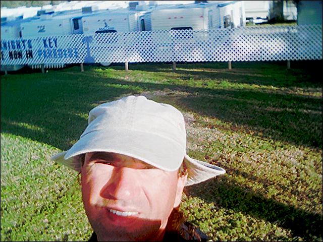 I made landfall at Knights Key Campground at 2:30pm. I beached the kayak and went for a walk to see what the conditions along the Seven Mile Bridge looked like. I knew that I could not attempt the crossing this late in the day. Seven miles in good conditions could take me four to five hours of paddling. And today the conditions were nowhere near perfect and I as already tired. I checked in with the campground administrative office and hired a site on the water for $30. This is a steep price compared to camping fees in the rest of the world, but all state parks, in Florida, charges a flat fee of $22.50 for campsites (no matter how small and rustic or large and comfortable), so the fee (especially in my circumstances) was very reasonable.
I unloaded the kayak slowly, made my camp in a sunny spot with deep green grass and then went for a walk around the large camp area in search of intelligence. I soon spied a group of campers with kayaks on their vehicles. I walked over and introduced myself and started talking kayak talk. It turned out that the two kayakers were experts at the sport and couldn’t believe I was kayaking to Key West from Miami without any prior experience, and alone. Then they walked back to my camp and observed my trusty green sea kayak. They were incredulous. They explained that I was paddling a large tree trunk and that it I would exert a quarter of the energy I simply switched to a better kayak. I explained that I felt that my $250 investment was a sound one.
They then began to quiz me on my safety plans in the event that I got washed out to sea while trying to cross the Seven Mile Bridge channels. I explained my evening cell phone procedure. At this point they really began to look concerned (more for the reputation of their sport than for me it seemed). It wouldn’t do to have a lot of bad press about a guy being washed out to sea in a kayak, even if it were a really cheap version of a kayak. So they came up with their own plan. They explained that their party would all be driving over to Bahia Honda Key State Park the following day and that they would set out a few hours after I set out. They would keep an eye out for me while driving across the bridge. Then they would expect me to meet them on the Bahia Honda beach late in the afternoon. If they didn’t spot me under the bridge or if I didn’t meet them on the beach in the afternoon they would begin a search. It sounded like a plan to me and I agreed.
I then set out for a walk across the old part of the Seven Mile Bridge to Pigeon Key. All the while looking over the railing at the rolling seas. I’d dove for lobster under this bridge a number of times in the past. And each time it was with close to 45 pounds of weight, at slack tide, with two anchors holding the boat in place and with two emergency divers in the boat to either jump in for rescues or to drive the boat out and collect the divers if they lost a hold on the bottom and were washed out to sea. In the best cases the conditions under the bridges were brutal and we were either washed out to sea, into the Gulf of Mexico or clung to the base of the old bridge exhausted until the boat collected us. But these were small prices to pay for the full bug (lobster) bags we would bring to the surface. Those dives were all in normal conditions, not in Small Craft Advisory conditions. I viewed the tumult beneath with serious attention and wondered if my journey was at an end.
I rested on the railing near Pigeon Key and determined that I should give it a try the following day if the conditions improved and that at worst I should at least try to make it to Pigeon Key (two and a half miles) where I could rest. I could then paddle between the new and old bridges in a straight line for three and a half miles and then break south to Mollasses Key if I got in trouble. Or continue on another two miles and then cut out to Money Key. From that point it would be another mile and a quarter to Little Duck Key, and then short hops along small bridges from key to key (Missouri and then Ohio) before finally reaching the long golden beach on Bahia Honda Key. By breaking the sections into smaller legs it didn’t seem so formidable, at least that was what I kept telling myself. The next day Neptune would have to grant me passage or the journey would come to an end.
I walked back to the camp area and then continued on down the highway to the western commercial edges of Marathon. I had a filling meal at a Chinese restaurant and then walked to Hog Key marina in order to find out about the next day’s tides and weather conditions. No one at the marina could offer any help in these matters. I was amazed that the staff at a large marina located in the heart of the keys could be so clueless about current or prevailing weather conditions. Apparently, the boaters that used this marina didn’t actually take their boats out to sea and if they did, they probably didn’t lose sight of land. They didn’t even have a radio tuned to the Coast Guard weather channel. Their best suggestion was to buy a newspaper and check the weather section. I left shaking my head in disgust.
By this time it was getting near sunset so I quickened my pace back to camp. At the campground I found the community restaurant and asked the staff for weather information. They pointed to one of the TV’s that was tuned to the Weather Channel so I sat down and waited for the regular local update that cycled every eight minutes. The forecast was not promising. The weather would remain cold, the winds would remain in the 20 to 25 MPH range and the Small Craft Advisory would remain in effect.
I thanked the staff and then returned to my little, but comfortable tent for the night. I had only covered nine miles that day, but I had used it wisely to prepare for the next day’s trek. I lay awake for a short time, staring at the stars through the tent mesh and marveled at how lucky I was to be on this adventure. I couldn’t help smiling to myself when I recalled the envy in the eyes of the kayakers I spoke to. Of how they marveled when I told them of my trip and its destination. They each stole glances at their girlfriends and I could see that they were not free to go off on two week whimsical kayak trips. With those thoughts I settled into what I hoped wouldn’t be my last night of sleep. I’d only paddled nine mile that day, but tomorrow would be a different story.
Day 9
I awoke in a warm and cozy sleeping bag at dawn and simply lay there listening to the birds and the wind. I could tell that it was still blowing hard and I could feel the cold on my face. But it was still early and it could turn as the sun rose and warmed the land (the land warms and cools four times faster than water). But eventually I had to get up and start my day. So around 7am I got up and began to break my camp. Surprisingly, the park was fairly active at this hour. Most of the elderly campers were early risers from the looks of things.
When all was packed into the kayak I sat on a picnic table and simply watched the sea for a while. I didn’t feel impeding doom, but I did feel as though I was in for another trying day. The next seven miles of open water and numerous smaller, but challenging, crossings would dictate the outcome of this adventure. If I didn’t clear this natural barrier, I would simply secure the kayak to a tree in a concealed place and catch the next Gray Hound bus back to Miami. On the other hand, if I cleared the area, I felt that no barrier could prevent me from reaching Key West. I felt the outcome could go either way. The weather wasn’t exactly cooperating. It was still very cold and the winds were out of the north, northwest, at around ten knots, and the tide looked like it had been going out for a while. That meant that it would turn at some point while I was in the channels. That at least would afford be about half an hour of slack current during the crossing.
7 Mile Bridge
After deliberating comfortably I realized it was almost 8:30am and time to be on my way. I settled into the kayak and pushed myself out as best as I could from the shallow and muddy beach. I hugged the shore as much as practical but quickly rounded the western edge of the key and into the wind. Staying in the shallows and near the shore kept me in seas that were choppy, but manageable. I then approached the eastern base of the bridges. At this point both the old and the new bridges share the same base. I paddled out under the piles of the new bridge and into the open area between the two bridges.
The old bridge was built on massive concrete and brick arched foundations while the new bridge sits on slender concrete piles that were driven into the seabed. The old bridge offered significant shelter from waves and wind while the kayak was behind one of these bases. But the water in the open arches was confused, deep and running fast. The wind would also impact my paddling.
I set out and had to counter paddle constantly to prevent the wind from turning the kayak. I also had to contend with the current that was pulling the kayak in a south to southeast direction. I felt as though I was riding on a roller coaster in a large bathtub. But at least the forces were generally pulling in the same direction. I eventually figured out a good northwest angle to for paddling and stability. It gave me forward motion and countered the effects of the wind and current. I still had to pay close attention to the confused waves that could easily pitch me from the kayak and end my journey and possibly my days.
My first target was Pigeon Key, about two and a quarter miles from shore. The old bridge connected with this key and the existing historical facilities. I made landfall just after 9:30am. The paddle had not been too difficult, but my butt was killing me and my legs were stiff and in need of stretching.
An old carved out boat landing still exists on the south side of the Pigeon Key that looks like a swimming pool open at one end to the sea. I beached the kayak at this spot, got out and stretched my legs and then sat to eat two granola bars and think some more about the next leg. The weather remained the same, sunny, cold and windy and looked as if it would remain in this state for the rest of the day. I could turn around now or I could set off to complete the adventure. I looked back towards Marathon one last time and then set off for the western side of the Seven Mile Bridge.
I continued paddling as before, in a slightly northwest direction in order to actually head west. The going across the Pigeon Key Banks was manageable until I reached the open channel that cuts the old bridge in half (the old bridge was torn down in this section so that high vessels could cross under the apex of the new bridge. Here the horizontal clearance is 30 meters and the vertical clearance is twenty meters, enough for most large vessels to enter and exit the Gulf of Mexico, rather than circling around Key West or the Dry Tortugas. The effect of that 30 meter of dredged channel was dramatic on the kayak. I felt as though I had entered the ocean proper, rather than the sea. The color and texture of the water changed from a lovely tropical turquoise to a deep and foreboding blue. I felt my adrenalin level ratchet up a notch, bent forward and focused on paddling to the other side of the channel where a concrete seawall would provide some respite.
I reached the other side only to find that the concrete wall didn’t really provide much shelter. The current and wind were in turmoil and lashing at the wall. I tried to settle the kayak at this location for a few minutes of rest, but found that it was impossible to hold it in place or upright without constant paddling and maneuvering. I then continued on my way. The target was now to stay between the two bridges, which were separated by about a 30 meters. This long stretch of bridge crossed three distinct channels, Moser, Molasses a then Money. Half way along this four-mile stretch and about three quarters of a mile to the south is Monkey Key. This was my next bailout point if I ran into problems.
I continued paddling and noticed that I could see the cars on the bridge clearly at his point. The gap between the two bridges was large enough here to effectively put me in open water. Time slowed to a crawl, my attention remained focused on the task at hand and I fell into a rhythm. Every once in a while I would hear a car or truck horn honk. I’d look up and see people waving or gesticulating in my direction. I couldn’t help but smile and wonder what those drivers were thinking when they saw a lone kayak, loaded with gear, crossing this expanse of beautiful sea. I lost all feelings of dread and now knew that I would make it to the end of this bridge, and probably the end of the Florida Keys.
While in this pleasant state I notice a lot of honking and looked up to see a van with two kayaks strapped to the roof. It was the campers I’d met the night before. They were cheering me on and hooting. They had slowed down to better spot me and I could feel their relief at finding me so far along. They waved goodbye and headed off. They would certainly beat me to Bahia Honda Key by a long shot. But I wasn’t in a hurry. My butt and legs had gone numb some time ago and I was feeling one with the sea.
I passed my bailout point to Monkey Key and continued on. There was no place to stop and rest and I was afraid that I wouldn’t be able to make it back to the bridge against the wind if I ventured south three quarters of a mile, simply to rest on the Key. I then noticed that the current had become subdued. Perhaps I was in slack tide? I couldn’t tell because of the waves being driven by the wind, but it did feel as though the going was easier.
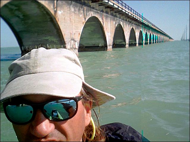 At last around 11:30 I reached the western end of the bridge. I angled to the south side of the narrow causeway in order to find shelter from the wind. Within a few feet of entering the lee of the causeway the world changed. The wind had completely disappeared. This small spit of causeway and the adjoining shallows provided enough shelter from the winds to completely change the feel of the day. Now the sun felt hot, the deep channel along the causeway was bordered by shallow sea grass and the going was straight, without the requirement of tacking, for a change. I found an easy place to beach the kayak and step out for a much needed stretch. I lay out on the seawall and rested for a while and then sat up to eat two more granola bars. I wasn’t done for the day, but at last I felt as though I had crossed the halfway mark of the keys.
I hopped back into the kayak with a cocky spirit and continued on past Little Duck Key, Missouri Key, and Ohio Key. This two and a half mile stretch was comfortable with two shallow channel crossings and mostly easy paddling to reach Bahia Honda Key. Bahia Honda is a fairly large key (three miles across) with a number of lagoons in its center and one of the Key’s prettiest National Parks. The beach in this park is almost a mile long, sits on the south side of the key and is made up of golden sand (a rarity in the keys). I continued paddling along the coast that was mostly devoid of boat or human activity. Then I heard my name being called out. Now that was startling. Who knew my name and who would recognize me this far off shore?
I looked hard and noticed a woman waving at me on the shore. I looked around and found no one else in the area, so I waved back (feeling foolish since I had no idea who she was). She kept pace with me as I paddled along and then it occurred to me who it must be. It was one of the campers I’d met the evening before at Knight Key Campground. Sure enough, I could see the kayaks sitting on the beach near a group up ahead. I changed my angle and nosed towards the group while heading west. When I was parallel and just outside the surf line I turned toward the beach and pushed the kayak towards shore with the help of the surf. I beached the kayak and jumped out to pull it up quickly. A number of hands joined me in the effort until we had it high enough to prevent the waves from rolling it.
I was then congratulated and hugged by the various members of the group while they asked questions excitedly and talked among themselves. I sat on the sand with them, ate another granola bar, drank some Kool-Aid and shared the adventure with them. They were particularly happy that they had spotted me while crossing the Seven Mile Bridge. They had anxiously kept an eye out for me the rest of the day, figuring that I’d pass the beach sooner of later, if I succeeded in the crossing. It was already late afternoon and they had begun to worry. They were quite relieved that they wouldn’t have to call the Coast Guard to explain that I might be missing at sea. We all laughed and then I shook hands and hugged before setting off again. They seemed genuinely happy to have shared a part of the adventure and I felt my spirits rise while recalling the line, “no man is an island.”
I patiently waited out the waves until I found a set that felt right, and then I pushed the kayak out as far as possible, jumped in, and paddled against the surf quickly to reach open water. Once beyond the surf line I turned back to wave goodbye. The group, and a number of nearby beach goers who had been listening to our conversations, where waving farewell. Word of my journey had spread on the beach and the community was wishing me well.
Beyond the beach I had an easy mile and a half of tame country before the end of Bahia Honda Key and the start of the old one and a half mile Bahia Honda Channel Bridge. This bridge looks different from the other old bridge sections in the Keys. It looks like a large steal Erector Set. It was more rightly a typical bridge for trains rather than cars back in its day. A large section of the old bridge had either collapsed or had been intentionally torn down. The remaining sections looked eerie and out of place. The water in the channel, under the bridge, was a rich deep blue, and teaming with small fishing boats. While crossing this channel I notice a number of fishermen landing fish. I was never close enough to see what type of fish they were haling in, nor was in inclined to paddle over to them and ask. I was growing tired and the water was deep enough to be taken seriously.
I crossed the channel to the lee side of the Spanish Harbor Keys, continued paddling another mile and a half along the mangrove shores to West Summerland Key and then across what would be my last channel of the day. This mile and a half channel felt a lot longer than it should have and I realized that I was very tired and that the day was drawing to a close.
I closed to the eastern tip of Big Pine Key at the base of the bridge and found a very narrow canal opening with a strange contraption blowing bubbles into the water. I crossed through the bubbles and into the narrow canal. It was lined with trailer homes on the south side and a dirt road on the north. This was a private campground/ fishing camp. I beached the kayak near the boat ramp and waked over to the general store. It was fully stocked and at the marina business was brisk. I stocked up on cans of baked beans, a cold Pepsi and a bag of Salt and Vinegar potato chips. I walked back to the entrance of the canal, sat on the seawall to eat my snacks and consider the remainder of the day. I could ask about camping here or I could squeeze in another hour of paddling. The map showed that the entire area along this southern shore was mangroves and protected national parkland. Most of Pine Island is natural habitat and a haven for the last remaining Keys Deer. I felt confident that I could easily find suitable and desolate camping before sunset, so I set off again. I never did find out what purpose the bubbles at the canal entrance served.
I continued along the south shore and found that it really was desolate. I continued along for about three quarters of a mile until I cleared the Southeast Point and then began looking for a campsite in a sheltered cove or bite. The beach area was completely covered in flotsam of all types and magnitudes. I didn’t know if the area was a natural collection point for trash and debris from Marathon or simply an area that has never been visited by a beach cleanup group. Around 5:30 I found a comfortable place to exit the kayak and make my way through the shale holes in the hard beach. On shore I found sand and enough elevation and dry sand under mangroves. I hauled my gear up under a group of trees with a nice dry hollow in their center. I setup camp easily and then set out for a walk.
I soon found that the beach area was a narrow strip. The area behind the beach was an open expanse of dried dirt. It was obvious that the dirt area had flooded at regular intervals and that it was used by occasional off-road vehicles (probably from the nearby camping area). I retraced my steps to my camp to dig out my cell phone and make my nightly update call.
I immediately became concerned when I opened up the five-gallon bucket that I used to house my dry gear. It had a few inches of water in the bottom and it looked like my cell phone and camera were floating around in a ‘not so water tight’ Ziploc baggy. I pulled the phone apart and dried out all the parts as best as I could under the circumstances. I then sat down on the beach and let the parts sit on a rock to collect the last of the day’s sunlight while I ate a cold can of baked beans. When no more light offered drying potential and I was out of beans, I reassembled the phone and tested it. The phone turned on but its behavior was very erratic. Obviously contacts were shorting. I made a number of attempted calls before disassembling and re-drying the parts again.
It would be so ironic if the phone didn’t work this evening and that a call was placed to the Coast Guard. I had beaten the most difficult hurdle on this journey only to be stumped by a simple technology failure. I kept drying the parts and blowing into the connector contact areas at the bottom of the phone, to blow out the obvious water that had pooled. I had noticed the presence of high power lines in the area while walking. They would lead back to the eastern tip of the key, parallel the highway and back to the marina and a pay phone if all else failed.
After many attempts, I finally got a call out and quickly blurted out my waypoints and not to expect future calls, just before the phone died again. I breathed a sigh of relief. The world knew I’d made it and that my phone must be acting up. I made my way back to my tent in the dark and fell asleep instantly. It had been a long hard day in which I’d covered 15.2 miles and some mighty big obstacles.
Day 10
I awoke at dawn to clear skies and calm seas. I broke camp and spend the day in a sort of trance. The paddling seemed easy and carefree. I was one with the crystal clear sea. No humans were about for much of the morning as I paddled across expanses of glassy water. It was as though I was floating three feet above a surreal world of indifferent creatures. I passed over many jellyfish, rays, and even a shark. As the day progressed I chewed away the miles and Big Pine Key fell away as did Summerland Key, Cudjoe Key and Sugar Loaf Key.
I was making good time in the lee of the land, but by mid-afternoon the wind was starting to make itself felt and I feared that it might be turning in order to present one more (and possibly an insurmountable challenge). I examined the charts for a time and contemplated my options. I could continue on my present course in the Atlantic, within the shelter of the mangrove islands and keys, or I could turn into Sugar Creek and cut a more direct route to Key West via the Inter Coastal markers and channels that hugged the highway to my north. The only problem with this venture was that I would have to double back a way to reach the channel on the north side of the highway. Alternatively I could risk a shortcut through the mangroves to reach the channel at the MM14 Bridge. This route was uncertain and could result in my getting lost and losing considerable time, but if I made it through I would shave off at least one day of paddling. I opted for this plan naturally.
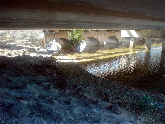 Sugar Creek turned out to be a clean man-made cut through the coral and mangroves (with an abandoned house at its base). The canal then opened into a broad and easy flowing deep river typical of South Florida mangrove keys and the Everglades. The river wound its lazy way to the north until it opened into the large and deep Sandlebunch Key bay. I cut strait through the bay and worked my way along the west bank until I found the very small stream marked on my chart. I followed this winding stream until it became no more than a ditch one meter wide and a third of a meter deep. It continued to wind in a generally westerly direction as the mangroves closed in on all sides. It opened into small shallow bays a few times, but at no point was the water deeper than half a meter and the bottom muck. After an hour of zigzagging I eventually ran out of forward options. Based on my GPS and the chart, I knew I was very close to the open water bay that I was seeking, but unfortunately I couldn’t circumvent this last clump of mangroves. I turned tail and back tracked to the opening of the stream. I then headed north until I found civilization and then explored my way in and out of canals, bays, and bayous until reaching the highway and the MM13 Bridge at last.
I tied off the kayak and walked along the highway to a side street and sat at a small park to eat my cold can of baked beans while watching kids playing baseball. I was back in the world. After eating I returned to the bridge and waited until it was clear of passing cars. I then hopped the railing and returned to the kayak beneath the bridge. I unpacked and setup my sleeping bag under the bridge for a noisy night. Sleeping under busy highway bridges is a trial in the best of times. Each time a car crosses one of the many expansion joints, the sound of the wheels are clearly heard under the bridge. When a truck passes the sound is amplified ten fold. I managed to sleep in fits at best.
Day 11
 I woke from a restless slumber at dawn. I repacked the kayak quickly and then set off to the south of the bridge, pushing and tugging the kayak to get through the shallows. I worked my way out to an opening and then along a narrow canal bordered by homes. I worked my way up and down canals until the last one ended at its northern end, about 50 meters short of the highway, next to a dirt road. A small storm drainage tunnel crossed under the dirt road and opened onto another narrow canal on the opposite side of the road. My charts showed that the canal lead to an open bay and then to channels that lead to Key West. I could unload the kayak, carry my gear and kayak across the five meter road and then reload the kayak to continue on. I crouched low and observed that there was enough room under the road to squeeze the kayak but not with me in it. I got out and tossed the line through the tunnel. I retrieved the line from the other side and yanked the kayak through the tight gap successfully. I jumped in without hesitation when it popped out and then paddled under the MM13 Bridge to the Gulf side of the highway. I continued along the now well marked route, crossed back under the highway, to the Atlantic side, at Similar Sound, followed the markers to the Cow Key Channel and then finally Key West.
I beached the kayak along the stretch of road that leads to the Airport. I got out tired and salty and jumped around looking very silly and happy to the passing motorists. I stopped a passing bicyclist and asked him to take a photo of me at the finish line (Key West).
After a short break and a granola bar, I got back into the kayak and paddle to my friend, Jeremy’s, house. He & Scarlet welcomed me with open arms and confirmation in their belief that I was crazy. I left the kayak tied to his dock, crawled into the hammock and fell fast asleep.
Day 1 Day 2 Day 3 Day 4 Day 5 Day 6 Day 7 Day 8 Day 9 Day 10 Day 11
Click the big yellow button to become a patron!
Link back to How-to post