
This post is about my “summit” of the highest mountain in the Netherlands — and yes, many people would call it a hill (including the folks at Cicerone’s High Points of Europe). The mighty peak in question is the Vaalserberg, topping out at 322.4 m (1,058 ft) above sea level near the town of Vaals.
Technically, I should say it’s the highest point in the European Netherlands. Here’s why: until 2010, the Vaalserberg really was the highest point in the country. Then the Caribbean island of Saba became a special municipality, bringing with it an 887 m (2,910 ft) volcano that now holds the national high point title.
Anyway, concerning the proposed hike itself, Hans, a regular organizer on the Meetup app, proposed a day trip from Brussels to the summit. Before signing up, I decided to do a little homework.

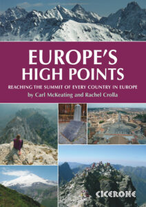
I opened the Adventure Travel Buddies app and downloaded the free “Cicerone High Points” pack, which lists all 50 European high points. The photos, info, and GPS track for the Vaalserberg made me smile — I’ve climbed plenty of countries’ highest peaks, but this would officially be my lowest high point to date.
![]()
Total Cost Range of this Activity is: Free
Free, free and free (ok, there was a metro ride and a small carpool fee).
Cristina and I signed up, even though late November weather can be a bit dicey. (She was secretly more excited about the backup plan: a spa visit in Vaals. Honestly, not a bad alternative.)

Start the Hike
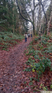
On Saturday we took the metro to the meeting point, carpooled to Vaals, grabbed a coffee, and met up with the rest of the group. Then we set off behind Hans on a winding town streets and country trails that took about two hours and covered 6.4 km. Along the way, we criss-crossed the borders of the Netherlands, Germany, and Belgium so many times it felt like we were country-hopping for sport.
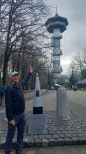
At the summit we were greeted not by a lonely marker but by a full-on amusement-park atmosphere. What used to be a simple tower has evolved into restaurants, attractions, and a souvenir shop. Still, it was a fun place to eat lunch and take the obligatory summit selfies.
To The Top
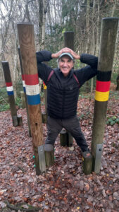
The Vaalserberg is also the exact tripoint between Germany, Belgium, and the Netherlands — known as the Drielandenpunt in Dutch, Dreiländereck in German, and Trois Frontières in French. After lunch we snapped a group photo on the three-borders marker, and I assumed Hans would lead us back to Vaals by a quick road or bus route.
Wrong.


Instead, he brought us on a scenic, meandering loop that added another 4.3 km and about an hour. No complaints — the forest trails were worth it — but my legs were absolutely ready for the “end of hike” drinks afterward.
We wrapped up the day with a final round in the nearby German town of Aachen and then headed back to Brussels.
Two GPS Track

Download the Vaalserberg-Cicerone-Hans tracks (in zip file).
Check out more GPS tracks.