
The Hawkesbury to Harbour Track (HHT) is around 59km in length (depending on whether you want to just walk forest or include the city/suburbs), but unlike the Great North Walk has no camping sites or or accommodation. However, it does have public transportation links strategically located along it’s length.

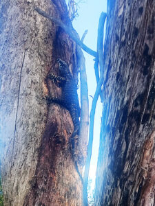
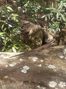
The majority of the track is single track with some rocky technical sections as well as some brief road and fire trail sections peppered throughout. There are historic indigenous sites located along or near the trail as it traverses Sydney’s sandstone bushland.
Typically the track is broken into 5 sections (see maps & facts for details) but I broke it up to suit my preferences for bush vs suburbs and access to public transport.
![]()
Total Cost Range of this Activity is: Free
Free, free and free (ok there are bus fares to and from each segment).
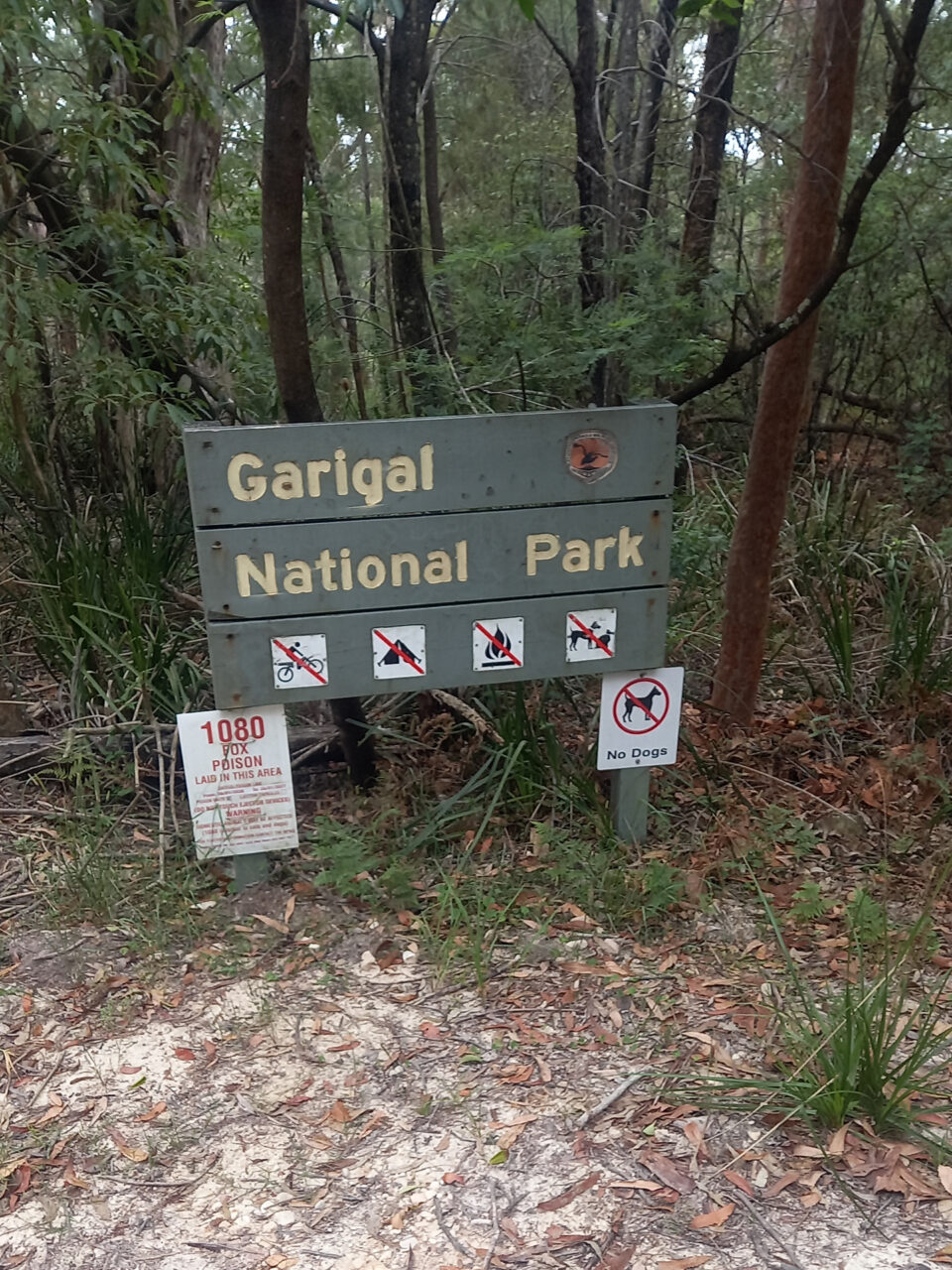
Hawkesbury to Harbour Track – My Part 1, St Ives to Berowra
St Ives is a good northern suburb access point (that includes Chase and N Turramura). The suburb sits on high ground between two water sheds/catchements (one to the north and one to the south), so it is optimal as a starting point for the first two parts of this 3-day hike. Optimal because it affords me the option to do part 1 and part 2 of this series in a downstream direction. In this case I started from the Ku-ring-gai Chase National Park carpark on the Warrimoo Track section of the HHT (at the northern tip of Chase).
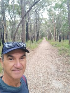
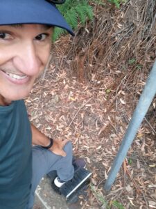
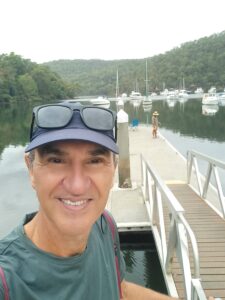
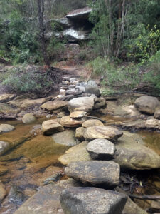
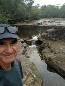
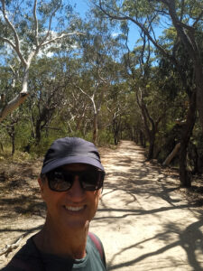
The track started through a forest on a gravel fire road with tall trees that showed signs of a recent fire (I guess that is why they have fire roads). About 1 km into the track the road gave way to a steep winding downhill groomed single track to reach the Cowan Creek stone crossing. Once across the trail parallels a much fuller Cowan Creek because of the additional flow from Kierans Creek for the next 4 km to reach sea level and the harbor of Bobbin Head. bobbin Head is a classy marina area with restaurants and lots of interesting things to do and a National Parks Information Center.
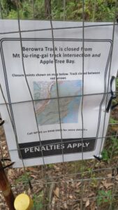
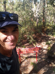
Once across the bridge I followed the trail over a 60m hill to reach the Apple Tree Creek boat ramp where I found a short section of the track closed for maintenance. I considered my options and then squeezed past the fence and cautiously continued north along the track and then passed the temporary fence at the other side of the closed section (in about 1 km).
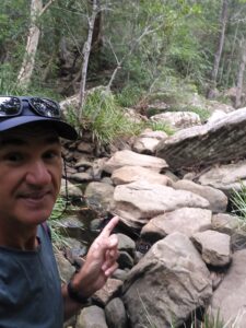
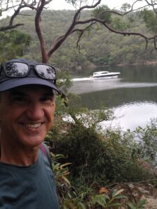
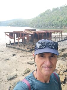
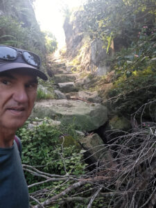
The next 5 km followed the Cowan Creek north (now a series of sea coves in reality and not a creek) until reaching Waratah Creek and the remains of a grounded houseboat. Here the trail left Cowan to follow the creek up a 2km steep winding track in ruff condition until it’s exit at an M1 footbridge. I crossed over the M1 and found myself at the Berowra railway station.
I crossed the street to purchase a takeaway late lunch and a drink before calling it a day (a 16km, 5 hour hike) and jumping on the train home.
There is an additional 5 km of bush track on the western side of Berowra but I figured I could do that short section another day.


Hawkesbury to Harbour Track – My Part 2 St Ives to Forestville
This is the second of the the three-part hike and was a 10.6 km generally downhill hike following the Middle Harbor Creek/Track from the Cascades. The Cascades are reached at the junction of French Creek at the bottom of 3 km of fire roads. See Maps & Facts for details. The trailhead I used was from bus stop on Douglas Street, St Ives.
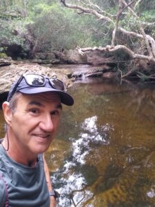
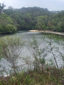
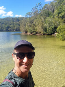
The creek/track is shaded and includes numerous small falls/cascades for the first 5 km, it then gains volume as it merges with Carrol Creek and track. The track then becomes the Lyrebird Track on Middle Harbor inlet, a lovely saltwater estuary with some sand spits, numerous trails on both shores and more interesting trail options higher up the slopes of the steep ravine walls.
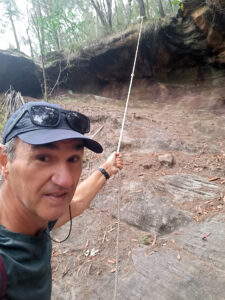
Incidentally, for the last 2km of this section I left the waterfront (Harbour to Hawksebury Track) and climbed steeply uphill (with the help of a rope at one point) to reach and then follow the Casuarina Track.
I was then in the northern housing suburb of Froestville where I caught a bus on A38 to end my 11km, 3 hour hike.

Hawkesbury to Harbour Track – My Part 3 Forestville to Seaforth
This third part covers 10 km of mostly downstream single track with three ascents in the second half.
I started at a bus stop in a residential neighborhood in Killarney Heights. Almost immediately I ran into a problem. The trail was closed for maintenance (Flat Rock Track) and suggested a long detour back up through the suburb. I ignored the sign and followed the very rough unkempt trail along the shore where the Middle Harbour Creek began to merge with the Middle Harbour. At the SE tip of Killarney Heights the closed Flat Rock Trail opened at the junction with the Magazine Track. Magazine descended to a lovely beach and then turned inland to follow a side inlet to Bates Creek.
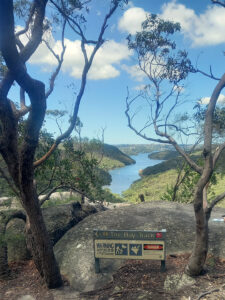
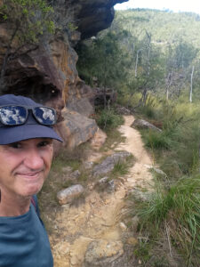
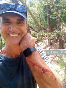
At a creek crossing the trail left the waterway to become Natural Bridge Track and wind its way uphill to The Bluff rock lookout where I rested before heading downhill on the Bay Track to retrace my prior 2 hours track but now on the opposite shore of the inlet (across from the Natural Bridge Track). Once back at sea level I followed the shore until I reached a lovely little waterfront park with picnic tables, pier and toilets.
At this stage the Timbergetters Track began on a steep 1 km winding groomed uphill route to reach a public park (oval) and bus stop where I jumped on a bus and called it a day.
Conclusion
I saw very few people on the Hawkesbury to Harbour trails (with the exception of on The Bluff) so I recommend this as a good off-the-beaten-path trail that is surrounded by city and public transport options. Note that I did not do the beginning 15 km city section from Manly to Seaforth (nor the city sections around St Ives). Finally I also skipped the final 5 km of trail on the western side of Berowra because I ran out of time.
GPS Track, Etc
Get all the Maps & Facts
Download the Harbour to Hawkesbury.gpx track.
Check out more GPS tracks.