
Return to Hawkesbury Post
My 3 Parts
Get more info on the HH Hike
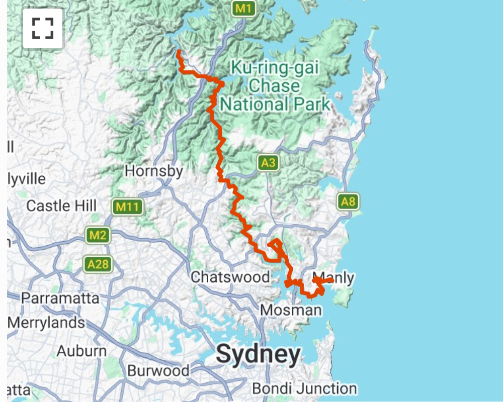
Hawkesbury to Harbour Itinerary
Typically the track is broken into 5 sections (Note that I did not follow this official itinerary)
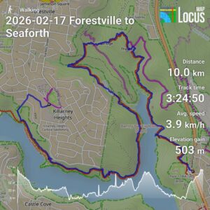
SECTION 1: MANLY TO THE SPIT [9.2km]
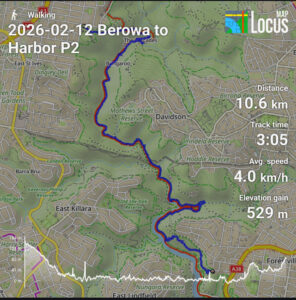
SECTION 2: SPIT TO DAVIDSON PARK [14.6km]
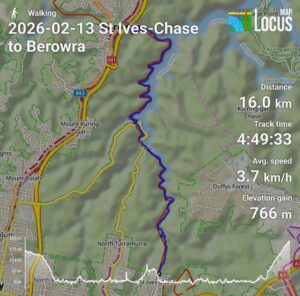
SECTION 3: DAVIDSON PARK TO ST IVES [11.6km]
SECTION 4: ST IVES TO BOBBIN HEAD [9km]
SECTION 5: BOBBIN HEAD TO BEROWRA WATERS (14.4km)
Details
SECTION 1: MANLY TO THE SPIT [9.2km]
0.0km Manly Wharf – start of Spit to Manly Walk
1.0km Kay Ye My Point
1.5km Manly Boatshed and start of North Harbour Walk
3.3km Forty Baskets Beach
3.6km Access track to Beatty St; start of Reef Beach Track
4.4km Dobroyd Head; start of Dobroyd Head Track
5.0km Crater Cove Lookout; start of Grotto Point Track
5.7km Aboriginal engraving site
5.9km Junction with Lighthouse Track to Grotto Point [1km return]
Start of Castle Rock Track
6.3km Castle Rock beach; start of Clontarf Track
7.5km Clontarf Beach
9.2km The Spit
SECTION 2: SPIT TO DAVIDSON PARK [14.6km]
9.2km The Spit
13.9km Seaforth Oval – start of Timber Getters Track
14.7km Bantry Bay Picnic Area – start of Bay Track / Bluff Track
16.7km Turn onto Natural Bridge Track
17.5km Turn onto Currie Street Track
17.7km Junction with Cook St; start of Bates Creek Track
18.4km Junction with Tipperary Ave track; start of Magazine Track
20.6km Flat Rock Beach
20.8km Killarney Drive track & start of Flat Rock Beach Track
21.7km Killarney Point
22.5km Access trail to end of Downpatrick Drive
23.8km Davidson Park
SECTION 3: DAVIDSON PARK TO ST IVES [11.6km]
23.8km Davidson Park & start of Lyrebird Track
27.0km Carroll Creek & start of Governor Phillip Track
28.6km Track crosses under pipeline
29.3km Stepping Stones & start of Middle Harbour Track
31.9km The Cascades & start of Cascades Track
32.8km Turn onto Upper Cambourne Trail
33.3km Cambourne Avenue (ST Ives)
35.4km Corner Kitchener Ave & Mona Vale Road
SECTION 4: ST IVES TO BOBBIN HEAD [9km]
35.4km Corner Kitchener Ave & Mona Vale Road
36.0km Management trail through Garigal NP
37.8km End of Phillip St
38.2km End of Warrimoo Ave & start of Warrimoo Track
39.5km End of service trail & start of bushwalking track
43.7km Bobbin Head Trail (to North Turramurra)
43.9km Empire Bay (Bobbin Head) marina
44.3km Bobbin Head (kiosk and NP info office)
SECTION 5: BOBBIN HEAD TO BEROWRA WATERS (14.4km)
44.3km Bobbin Head (kiosk and NP info office)
45.6km Apple Tree Bay – start of Berowra Track
46.5km Junction with Mount Ku-ring-gai Track
48.1km Apex of second bay (Winson Gully Bay)
49.0km Apex of third bay (Lords Bay)
51.1km End of Waratah Bay (track ascends from here)
53.0km Berowra Station
53.8km Start of Crowley Trail (on Crowley Road)
54.7km Turn into Berkeley Fire Trail
55.7km Berkeley Fire Trail meets Benowie Track
56.0km Naa Badu lookout
57.1km Junction with Currawong Fire Trail (to Currawong Road)
58.7km Berowra Waters
Download the Harbour to Hawkesbury.gpx track.
Return to Hawkesbury Post