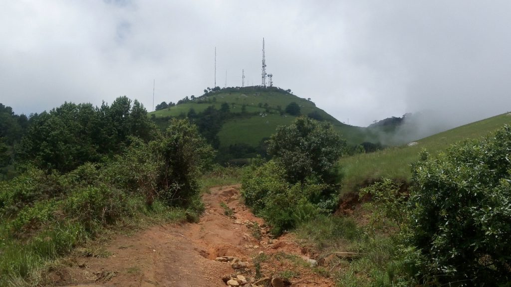
The Zomba Mt Malumbe hike is a day outing near Blantyre, in Southern Malawi. I provide details that include maps, costs, logistical requirements and facts as well as links to additional details, photos and videos. This is a self-guided adventure on a shoestring. Follow the links to dig deeper into the adventure.
We did this hike in January, the heart of the rain season in Malawi, on a very rare sunny morning. We started out from the parking area in front of the Sunbird. Note that we parked in the free area at the foot of the Sunbird gated parking lot. See GPS waypoints and track data below.
The hike started with a stroll past the trinket & mountain fruit vendor stalls and then continued back up the paved road for a short distance. We turned off onto the actual trail (a dirt farm track) next to another trinket stall.
Zomba Mt Malumbe Hike
Now the duel track route becomes a 4×4 track used by hikers and service vehicles trying to reach the cell phone towers on the summit. Note that I wrote ‘trying’ here. While we hiked a large farm tractor tried to reach the upper plateau but got bogged down too many times and eventually turned back.
The hike along the track to the upper plateau is quite lovely, has a number of small waterfalls and streams along the way (wet season only perhaps) and sweeping views. It follows below the ridge with parts shaded and parts exposed.
From the upper plateau we cut left at a sharp bend (straight goes on to the grotto and Chirodzulu summit). The upper plateau is a rolling grassland. The track on the last km below the summit began to zig-zag as it gained altitude.
Zomba Mt Malumbe Hike Summit
The summit of Mt Malumbe (2077m) is actually inaccessible. The top is covered in cell towers, dishes and other telecommunications equipment and the entire area is fenced off. The track ends at a locked gate. Just before the gate there is a faint trail leading to a lookout (about 20m from the track). Its not much of a lookout, but beggars can’t be choosers.
Unfortunately, clouds closed in on the summit when we were about a km from the top and a distant thunder storm began to threaten rain almost immediately upon reaching the summit. Views were obscured and rain drops began to fall. So we took a few photos and then turned tail and began the now slippery descent.
The rain drops stopped as we descended and the sun was shining again as we reached the car about an hour later. All in all we felt the hike was lovely, the views spectacular, the landscape lusciously green and the trail easy to walk. And the bonus was the availability of excellent (and reasonably priced) food at the Casa Rossa restaurant, located half way down the escarpment road back to the lower valley.
Accommodation on the Zumba Mountain Road
Case Rossa (Closed on Mondays) Half way up the road leading to Plateau
Lodge, Campsite & Restaurant
info@casarossamw.com
+265 (0) 881 366 126
+265 (0) 991 184 211
Mark & Silvia owners and Ann helps out.
Camping 7500 Mk pp (includes coffee,tea, juice, toast & jam breakfast).
Has rooms & a very good Italian restaurant
Good source of info about Plateau and other areas
For more options see the Zomba Plateau hike Accommodation section.
Zomba Mt Malumbe Hike GPS Data
Download the malumbe gps gpx file and load it into your phone’s Google maps or a phone GPS app such as Locus. Then you will have a track on your phone that you can follow when confused.
Here is the plateau plateau map.pdf map and here the Zomba village zomba map.jpg map.
See other Zomba Hikes here.
Checkout Mulanje Maps & Facts for more logistical details.
Visit Malawi Outdoors on a Shoestring for more adventures

